Yellowstone Region: Island Park and Mesa Falls, Idaho
Yellowstone Region -- Island Park and Mesa Falls, Idaho
Some of the best things to see at Yellowstone -- especially Geology -- are just outside of the park.Hot Spot Calderas
Part of the big story of Yellowstone is the fact that it's a caldera (a volcano that collapsed in a gigantic eruption). If it weren't, Discovery Channel & BBC wouldn't have made popular the word "supervolcano," and Hollywood wouldn't have made terrible movies about it!The problem is, you can't really see the caldera in the park! To see a caldera, I take curious travelers to Island Park, on the west border of Yellowstone in Idaho, where you can stand in the middle of the caldera and see its rim most of the way around you.
And Island Park is where the Really Big eruption occurred 2 million years ago -- it was not in Yellowstone!
Why Visit Island Park?
Island Park, Idaho, has beautiful forest and meadows, springs, rivers, waterfalls, a lake, a high mountain peak you can drive up, moose, bears, and plenty of roads and trails for all kinds of vehicles, bikes, ATV's and snow machines. It has lava flows, obsidian, glacial deposits, and a caldera you can actually see -- it's Yellowstone without the geysers, crowds, and restrictions!Activities: Hiking, biking, floating on Henry's fork, ATV/motorcycle trails galore, snow machines, cross-country skiing, exploring by vehicle.
Time: 1-3 days for the sites described here, or choose any one for a part-day trip. Many people spend their entire vacation in Island Park. If you just want to check it out, plan on 2 days to see the best stuff. If you have ATV's or mountain bikes, you'll never want to leave!
Difficulty: Island Park is mostly pretty flat, so even hiking here is easy. The eastern hills and the Sawtelle - Jefferson peaks offer fantastic moderate hikes. I've taken small children on the paths to Sheep Falls and Mesa Falls, but the more limited folks may find them a bit challenging.
Climate: Island Park sits at about 6000 feet, and so gets snow several feet deep in the winter and lots of those wonderful summer afternoon thunderstorms. It gets a bit less rain and snow than Yellowstone, which makes for better weather.
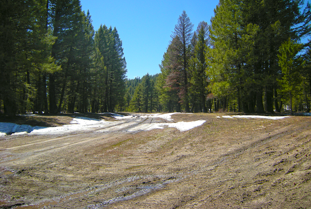
Roads & Seasons: A great number of dirt or gravel roads and trails are groomed in winter for snow machines. In Spring the mud here isn't sticky or deep, so exploring isn't limited as much by wet conditions as in other places, but use good judgement based on your vehicle and tires. Don't try to drive off-road on the snow or across drifts, especially in Spring when it's thick and deep - you WILL get stuck.
Land: Most of Island Park is public land. Please respect the private land you may come across.
Facilities: Island Park caters to visitors, so you'll find several convenience/ grocery stores, gas stations, and places to eat along Main Street (Highway 20). My favorite is Robin's Roost grocery store, fast food, and Chevron station in northern Island Park, Hwy 20 at South Big Springs Loop Rd / Sawtelle Peak Road. Oddly, no place in Island Park has restrooms suitable for a big group -- just one-holers. Best restroom stop for a group is the Forest Service restrooms at Mack's Inn.
Lodging: There are several inns and lodges scattered across Island Park. Consider renting a cabin for a longer stay, especially if you have ATV's or snow machines. The Forest Service also runs several campgrounds throughout the area. Commercial and Forest Service campgrounds and RV parks can be found HERE, or by an easy web search for "island park campgrounds."
Cautions: Island Park is grizzly bear and moose country. If you go away from populated places, use appropriate back-country cautions. Moose show up along the rivers at any time -- give them wide berth! Moose are permanently grumpy and very territorial; they will stand their ground and drive you off if you get too close for their comfort. And don't even think about the grizzlies (they're not seen very often, anyway, because they don't like to be around people, just food).
(Map) Access to Island Park is by U.S. 20, America's longest highway.
Geology of Island Park
See my Volcano Primer page for terminology.Island Park was the "Yellowstone" of 1-2.5 million years ago (it's where the hot spot was). Currently, the hot spot is centered under the north end of Yellowstone Lake. On the map above, you can see the semicircle of forest that is the caldera rim (south of the "Island Park" label). It is called the Henry's Fork or Island Park caldera (for simplicity, I'll just call it Island Park). The Island Park caldera formed in a series of mind-bogglingly huge eruptions -- the Huckleberry Ridge Tuff 2.0 million years ago was 2500 cubic km., and the Mesa Falls Tuff 1.3 million years ago was 280 cubic km. For comparison, the "big" eruption of Mount St. Helens in 1980 was 1 cubic km. ONE. Vesuvius buried Pompeii with 8 cubic km. The Island Park eruptions were so big, they almost certainly changed Earth's climate for years or decades afterwards, or longer, and caused continent-wide extinctions. These eruptions buried Kansas in 3 feet of ash. They were BIG.
And that was from the Island Park caldera, not Yellowstone. The big eruption that formed Yellowstone caldera was the Lava Creek Tuff 640,000 years ago, and it was about 1000 cubic km. That's big, but not half as big as the Huckleberry eruption from Island Park.
Volcanic activity at the two calderas overlapped for hundreds of thousands of years, right up to the youngest lavas. While Yellowstone continues to release a lot of heat in the form of geysers and hot springs, and has seismic activity that indicates active magma, these phenomena do not occur in Island Park.
The eastern skyline of the caldera is the 800 foot-thick "Buffalo Lake" rhyolite & obsidian flow that filled and spilled out of the Yellowstone caldera about 160,000 years ago, covering the eastern quarter of the Island Park caldera. It sits on top of the Lava Creek Tuff, which is present in the lower hills of eastern Island Park. Island Park was the site of continued eruptions, mostly basalt lava flows, up to about 29,000 years ago. You can see the youngest volcanic rocks on the western rim of the caldera, west to northwest of Harriman State Park.
Yellowstone Hotspot Eruptions at Island Park
Here are the biggest eruptions, youngest first ("tuff" is what we call a pyroclastic flow & ash after it has lithified):Buffalo Lake Rhyolite (Yellowstone), 160,000 years old, forms much of the Pitchstone Plateau between Island Park and Yellowstone. Contains a lot of obsidian.
Lava Creek Tuff (Yellowstone), 640,000 years old, rhyolite, 1000 cubic km, formed Yellowstone caldera.
Mesa Falls Tuff, (Island Park), 1.2 million years old, rhyolite, 280 cubic km, formed eastern Island Park caldera.
Huckleberry Ridge Tuff (Island Park), 2 million years old, rhyolite, 2500 cubic km, formed western Island Park caldera. This is "The Big One."
There are two types of volcanic rock in Island Park -- the dark rocks are basalt, and the light ones are rhyolite. You have to break open a fresh surface to see the true color (the outside gets stained by dirt and weathers to different colors). Rhyolite is the type of magma that is most likely to erupt explosively because it is so thick even when hot that gas bubbles explode the rock when they decompress (like CO2 in soda) when the magma reaches the surface or is suddenly depressurized. The hot spot's big eruptions were all rhyolite. Obsidian here is rhyolite, too, but it's dark because it is glass contaminated with iron, magnesium, calcium, and many other elements.
I can't post the geologic map here because it has not been published yet. But I know a guy...
Springs
Some of the best sites to see in Island Park are the springs. Volcanic rocks naturally fracture when they are deposited and cool off. Those fractures form easy pathways for groundwater flow. Island Park has at times been filled with lakes and glacial sediments, which form an impermeable barrier below the tuffs and lavas that came out of Yellowstone. As a result, snowmelt and rainwater flow easily down into the volcanic rocks in western Yellowstone, but hit the sediments and travel horizontally. The water exits the lava flows on the east side of Island Park in a series of big springs (Big Springs, Buffalo River springs, and Warm Springs). The water isn't geothermally hot, it's just rock-temperature warm.Here are the good Geologic sites, listed from south to north:
Warm River
(Map) Google Street View is available here, so you can see what Warm River and the Fish Creek Road turnoff look like. Their pictures don't do it justice!
To get to Warm River from the south, turn off highway 20 in Ashton and take the Mesa Falls Scenic Byway. From the north, you take the Scenic Byway from the big open area just north of Henry's Fork bridge and Harriman Park in Island Park (there are good signs to it).
Warm River is a pleasant spot that doesn't get all the tourists. This is where Warm River meets Henry's Fork. It's a good place to fish (that's an understatement!), wade in the river, bicycle, just hang out and enjoy the scenery, or camp (very nice campground!). The bedrock is the 2 million year-old Huckleberry Ridge Tuff ("The Big One"), with a young river-channel basalt flow on some of the hills.
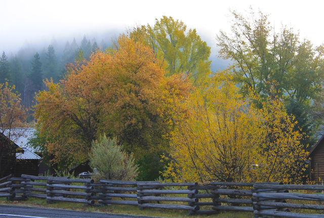
(Above) Autumn fog at Warm River.
(Above) Warm River Campground. Fish Creek Road is off the left side of the photo, and Mesa Falls Scenic Byway is on the far side of the river.
Fish Creek Rd. -- The Road To Nowhere
My personal favorite road in this whole region is the Fish Creek Road (082) because it takes you right along the Yellowstone National Park boundary in scenic forest, up-close to intriguing geology, and nobody goes there! I've driven the entire length of this road during the height of mid-August tourist season and not passed one single vehicle! So in a way, I hope this trip doesn't get very popular!I suggest doing this trip as a loop with the Mesa Falls Scenic Byway, starting at the north or the south end. Fish Creek Road goes from Warm River north into eastern Island Park, and is paved from Warm River for several miles northward to just past road 161, Baker Draw Road. Past that, it is graded gravel that is suitable for sedans except when it's muddy. It was made decades ago for the logging industry, so now it goes "nowhere," just like I like it.
At times the road is popular with bicyclists, so please watch for them and be cautious at blind curves.
The north end comes out on the South Big Springs Loop here 44.486394, -111.282695, or you can take a more southerly route on Chick Creek Road (161) out to highway 20. Chick Creek Rd.'s east end is here: 44.428356, -111.143790. Its west end is here: 44.393464, -111.383928 at a big parking turn-out on Hwy 20. These both make good entrance points if you're doing the road from the north.
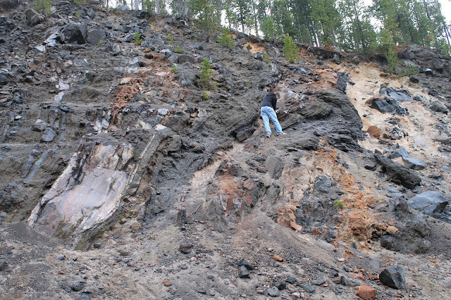
The best geology to see along Fish Creek Road is the "Buffalo Lake" obsidian. You'll see it best exposed in road cuts, like this incredible one: 44.304229, -111.161264 It's 160,000 years old, and flowed under tremendous heat out of the Yellowstone caldera from the east. You can find red and black obsidian in the road cuts.
Read my page on Geologic Etiquette before you get out your hammer!
(Above) This is the biggest road cut along Fish Creek Road, and it has both black and red obsidian. A molten obsidian flow is thick like taffy, so as it flows it tumbles and rolls, creating these steeply inclined layers. It's glassy because its temperature was too high for any minerals to form, and then it cooled quickly. Please be considerate of others who will visit after you -- don't mar, chip, scratch, remove, or ruin the outcrop. If you must take a rock, find one that has already fallen from the outcrop (there are always plenty of those).
(Above) A gorge along Chick Creek Road, about 2 miles west of Fish Creek Road. Location is here: 44.414988, -111.181400 Bedrock here is the Buffalo Lake rhyolite, about 160,000 years old.
Mesa Falls
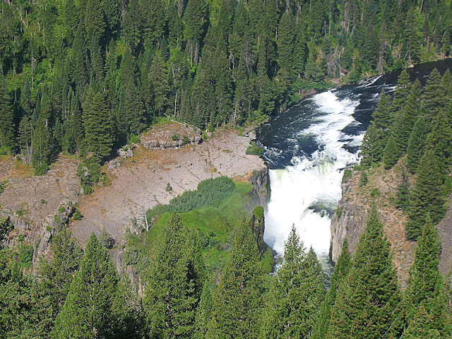
(Above) Visit the falls in the morning to see the rainbow. The falls are 114 feet (35 meters) high, and have created a green microclimate in the surrounding cliffs.Henry's Fork river exits the Island Park caldera by cutting through the southeastern caldera rim and dropping down to the Snake River Plain east of Ashton via two major waterfalls -- upper and lower Mesa Falls. Sheep Falls (described below) is farther upstream, and is at the beginning of the river's deep canyon.
Mesa Falls has a beautiful old log lodge visitor center and well-done interpretive signs. Outhouses are available outside the lodge and at the lower parking lot, where drinking water is also available in the warm seasons. There is a small admission fee of $5 per vehicle from about Memorial Day to Labor Day, and it's well worth it. No food is available.
The paths down to the falls are paved and have moderate slopes and a lot of stairs.
You can access Mesa Falls in winter on a snow machine from either direction or by cross-country skis or snow shoes from a parking area a few miles to the south. In Spring, the road may be blocked by snow. It's steep and narrow, so if the road is snowy, use caution.
This place is so much more than a waterfall! A river canyon has existed here for tens of thousands of years, and lavas from Island Park have occasionally made their way through it. The sequence works like this: lava fills the river channel, then the river erodes down along side of it, leaving a remnant of the lava on the new canyon walls. In all, 5 eruptions in Island Park have sent lava flows down this canyon. Only two can be seen from here. You'll see them in the cliffs along the path -- the dark fractures full of vertical fractures (cooling joints). The same flows do not exist on the far side of the canyon because the river has shifted over that direction and eroded them away.
The slopes above the parking lot and nearest the scenic byway are the Hatchery Butte basalt, which is 81,000 years old. The ledge at the top of the falls and under the walkways is the Pinehaven lava flow, the youngest in the area at 29,000 years old. It came down the river from all the way across Island Park on the west side! And ponder this: Mesa Falls is one of those rare places where the younger rock layer is lower than the older!
The Mesa Falls Tuff (1.3 million years old) makes up the cliffs on the far side of the canyon. It is rhyolite, and consists of three major ash eruptions that may have been separated by months to years in-between.
Waterfalls slowly migrate upstream. The plunge pool at the bottom of the falls steadily undercuts the falls, causing occasional collapse of the fractured columns of basalt. Every time that happens, the falls move upstream a few feet. These falls have migrated up the canyon, and eventually will deepen the canyon up into the caldera.
(Map) Zoom in just a little to see the Upper Mesa Falls Interpretive Site, and zoom out to see how to get there from the Mesa Falls Scenic Byway and Highway 20.
(Above) The walkways take you right to the edge of the falls! From above, the river looks so gentle and smooth and the falls are hardly visible. Looks can be deceiving!
(Above) The walkways give you spectacular, vertigo-inducing views over the falls and the canyon.
(Above) At lower Mesa Falls, you can see the old river channel and the old falls. The river has since shifted to the right, cutting new falls that have retreated upstream. This view area is not far south along the scenic byway from the upper falls.
Warm Springs
These unimaginatively named springs create a tributary to Henry's Fork river, not far NE of Mesa Falls. There is a U.S. Forest Service 12-person cabin there that you can rent. See it here. It gets booked months in advance, so be early!The bedrock here is the Lava Creek Tuff rhyolite, 640,000 years old, that erupted from the Yellowstone caldera.
Use this map to get to Warm Springs. From Mesa Falls, drive north up the scenic byway about 8/10s of a mile and take forest road 150 to the east, then right on road 154. The road is dirt, but is suitable for sedans unless it's muddy. Coordinates of the springs parking area are 44.205607, -111.251918
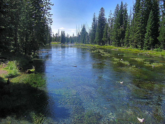
(Above) The Warm River springs put out 50 degree F (10 C) crystal-clear water all year 'round.
(Above) The scenery at Warm Springs is enough to put you into a serene trance! What a place to relax.
(Above) Warm River Springs and cabin in winter. (US Forest Service photo)
Sheep Falls
Sheep Falls is the northernmost falls that Henry's Fork has created on its exit through the caldera rim. They're in a secluded section of the river in southern Island Park, accessible by a dirt road and a 1/2 mile trail. The road is passable for sedans unless it's muddy.The bedrock here is the 1.3 million year old Mesa Falls Tuff, overlain by younger basalt lava flows that followed the river channel. From the river channel northward across most of Island Park is the 81,000 year old Hatchery Butte basalt lava flows that extruded from the volcano located here: 44.266471, -111.362407 Note that these lava flows are younger than the Buffalo Lake Rhyolite & obsidian that flowed out of the Yellowstone caldera.
(Map) Take the Sheep Falls road from Highway 20 in southern Island Park (zoom out on the map). The parking spot for the trail is a left turn that's marked with a sign. Coordinates of the parking area: 44.200012, -111.400134
(Above) One of the nice things about Sheep Falls is that you can walk right out onto it. There's room enough to picnic there, too!
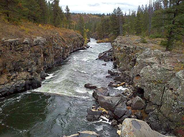
(Above) The view downstream from on top of Sheep Falls.
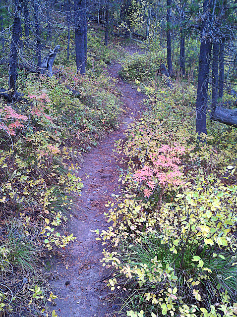
(Above) The trail to Sheep Falls is easy enough to take small children on. Those who have trouble walking on hills may find it challenging. It sure is pretty in the Fall!
Buffalo River Springs
Here's another secluded spot. I've spent a July day here with my family, and not one other person showed up!
Like the other large springs, the Buffalo River springs emerge from a volcanic layer that erupted from Yellowstone and filled the eastern part of the Island Park caldera. Groundwater trickling in from above is stopped by an impermeable layer either within the tuff or where it lies on impermeable sediments. This formation is the Lava Creek Tuff rhyolite, 640,000 years old.
(Above) Map to Buffalo River springs. Access from Highway 20 is via Chick Creek Road.
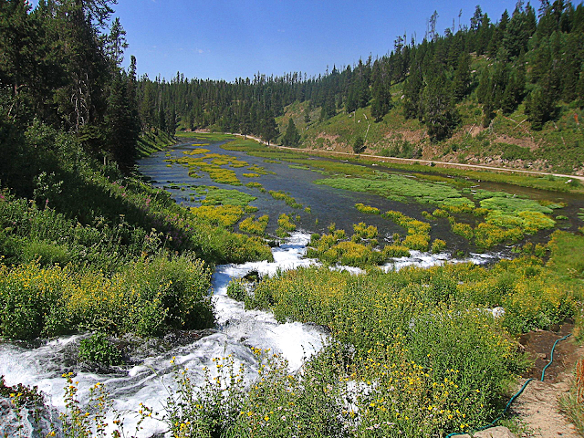
(Above) The Buffalo River, like much of Henry's Fork, is fed primarily by springs. Here, the springs emerge through bubbling sand under the leafy greens. As you can see in the photo, you can drive right to a spectacular picnic spot.
(Above) The upper Buffalo River joins the springs at the road's end.
(Above) The road to Buffalo River springs is dirt, but easy for sedans unless it's muddy. You don't have to cross any gullies or deep ruts.
Big Springs
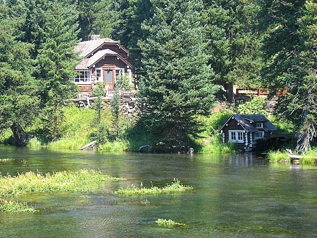
Just like the Buffalo River Springs, Big Springs emerge from the bottom of a Yellowstone volcanic layer, the Buffalo Lake obsidian flow that's 160,000 years old. It forms most of the eastern skyline. You won't believe the crystal clarity of the 52 degree F (11.1 C) water! You can feed trout from a bridge (you can even buy fish food there from a coin-operated vending machine), and if you're lucky you may see the big muskrat that lives under the riverbanks. It's quite a sport to try to feed the fish without a seagull intercepting the food! A campground is nearby, and the Johnny Sack cabin is a quaint, interesting attraction with pioneer history and intriguing craftsmanship.
(Above) Big Springs is on a good paved road. The turnoff from highway 20 is at Mack's Inn, on the south side of the river. The road is a loop off the highway, but the northeastern quarter past the springs is gravel and can be muddy.
(Above) Crystal-clear 50 degree water bubbles up from the bottom of the obsidian flow. When it weathers, obsidian turns dull gray like the outsides of these boulders. Wherever you see the black, pebbly dirt, you're on obsidian.
(Above) View from the bridge, looking downstream. Big Springs supplies most of the water to Henry's Fork river. About 1/4 mile below Big Springs is a boat launch. I highly recommend the lazy float from there down to highway 20 at Mack's Inn. It's safe and shallow enough to take small children and non-swimmers (if you fall in, just stand up!). You're pretty likely to see a moose along the way, too. You can rent boats or tubes at Mack's Inn on a first-come, first-served basis.
(Above) The trail to the Johnny Sack cabin is a couple hundred yards to the south (right) at the campground. Find out more about this unusual attraction HERE.
Sawtelle Peak
See that high mountain in northwestern Island Park, the one with the gray dome on top? That is Sawtelle Peak, and you can drive to the top! The peak is 9906 feet (3019 meters) in elevation, giving it a tremendous 360-degree view of Island Park, Yellowstone, Henry's Lake, southwestern Montana, and the Centennial Mountains. Sawtelle Peak Road is located in the northern part of Island Park. Turn west at the signs for Subway, and just follow the road.
(Above) The Sawtelle Peak road is suitable for most cars, but use caution in wet or snowy weather. The road is groomed in winter for snow machines. There are some trailheads that take off from the Sawtelle Peak road to go west toward Mount Jefferson, but remember that this is grizzly bear country and take appropriate cautions.
(Above) The Federal Aviation Administration radar dome helps identify Sawtelle Peak. The peak has Eocene (about 34 million year old) volcanic rocks sitting on top of Paleozoic sedimentary rocks -- all older than the Yellowstone hot spot. These mountains likely extended southeast across Island Park before the hot spot moved in, but formation of volcanoes and collapse of the caldera destroyed that part of the mountain range -- no trace of it remains.
(Above) Panorama to the north from Sawtelle Peak, overlooking Henry's Lake. The lake is surrounded on three sides by the continental divide -- on the far peaks, Raynolds pass to the left, and the nearer mountains on the left side.
Yale-Kilgore (or Kilgore-Yale) Road
One of my favorite autumn drives, this road takes you out to genuine Western country with ranches and wildlife. It's a great place to meander and just enjoy scenery. If you want, you can take it all the way to Kilgore or I-15 at Dubois (56 miles via road A-2) or Spencer (59 miles via Kamas Creek Rd #006). The first gas is at Dubois. Kilgore has a small store and RV park open in summer, but no gas.There are also several dirt roads that take you a short distance into the Centennial Range. The best one is the Keg Springs road several miles west at the Fremont-Clark County line. It's right at the end of the pavement (the rest of the road to Kilgore is graded gravel), and it goes up to a trailhead to beautiful, secluded Blair Lake just over the continental divide. Keg Spring road is only appropriate for SUV's, trucks, and Subaru Outbacks -- it requires some ground clearance.
(Map) Google Street View is available on this road all the way west to the end of the pavement at the county line.
(Above) Autumn colors on the Yale-Kilgore road west of Island Park.
(Above) From the Keg Spring road, you get a good vista back toward Island Park. This is an autumn view. From foreground to background you can see the Island Park reservoir, the caldera rim, the far caldera skyline (left) made of the Buffalo Lake rhyolite, and the Teton Range. Good ground clearance is required to drive on this road.
(Above) I gave this lovely lady wide berth when I met her along Keg Spring road. She is about 6 feet tall at the shoulder, and didn't back up a single step while I was there (and being a gentleman, I didn't try to make her). The pieces of bedrock in the foreground are the 2 million year old Huckleberry Ridge Tuff, "The Big One" that erupted from the Island Park caldera.
Red Rock Road (#053)
Another favorite spot of mine to get away is Red Rock Road. It takes you west -- all the way to I-15 if you want to! -- through seldom-visited Red Rock Valley and its wildlife refuge. The views of the gorgeous Centennial Range alone are worth the trip! You can learn more about the Red Rock National Wildlife Refuge HERE.Most of this is a graded gravel road, so if your vehicle is quite low, or you don't like dust on it, this probably isn't for you. It's best in a truck or SUV, but I've done it in a car. Not advised when muddy, especially during Spring snowmelt. There are no gas or facilities on this road, so only go with a full tank and supplies. The next gas is along I-15 at Lima (72 miles, north on I-15) or Dubois (87 miles, south on I-15), or back in Island Park.
There is quite a bit of private land along the mountains in the western valley near Lakeview, so please respect the signs and fences.
(Map) The signs to road 053 say "Red Rock Road." Take this road as far as you like. If you have an entire day and some maps, go all the way to I-15 at Monida, and take I-15 south to Stoddard Creek, where you can take Camas Creek Road (#006) all the way back to Island Park via Kilgore and road A-2. It's a gorgeous trip, and takes most of a day.
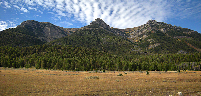
(Above) The gorgeous Centennial Mountains are seen by very few, yet are one of the prettiest mountain fronts in the Yellowstone region -- prettier than any mountains in Yellowstone, in my opinion. The upper valleys were glaciated down to where the valley becomes "V" shaped. A seismically active normal fault runs along the mountain front, and is considered one of the most significant earthquake risks in the region.
<end of trip>
Related Posts: other trips with the Yellowstone label
B.S. -- Popular Misconceptions
Yes, Yellowstone is an active volcano, but NO, a super-sized eruption is not likely and NO, you can't say one is "due." Volcanic eruptions are not generally cyclic. If an eruption were to happen in Yellowstone, it would almost certainly be a local lava flow or dome. That's what usually happens in a caldera -- it fills in with lava flows or lava domes. The chances of a super-eruption happening in your lifetime are vanishingly small -- too small to even consider. Or make a movie about.
M.S. -- More Science
Geology from the National Park Service
From Montana State University
From the U.S. Geological Survey's Yellowstone Volcano Observatory
The Yellowstone Volcano Observatory has information about geology, seismicity, deformation, and other ongoing events at the Park.
Ph.D. -- Piled Hip-Deep
A bit more in-depth info on all aspects of Yellowstone by wonderful Carleton College.
Ground deformation in Yellowstone from U. of Utah.

