Posts

Watkins Glen State Park, New York

Image
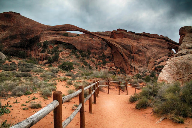
  Watkins Glen State Park, New York Google Earth view looking upstream, eastward, from Watkins Glen. Geology of Watkins Glen State Park Surficial geologic map of the Watkins Glen area. Glen Creek cuts across glacial gravels and down through the ancient bedrock.        Glacial deposits are orange, light pink, purple, and brownish orange, and are made of gravel.  The red pattern is the bedrock seen in the canyon. The olive color around Seneca Lake is river deposits.      During the last ice age, this area was covered by the continental ice sheet flowing southeastward out of Canada.  Where the ice was able to carry sediments and loose bedrock away, it carved out the 11 Finger Lakes.        Contrary to popular thought, glaciers are not like "bulldozers" -- they are not dense enough to push large amounts of sediment and rock.  Instead, they are very effective conveyor belts that drag material along their bottoms.  When the ice pauses in one place, the ice continues to move in the

Big Thompson Canyon and Mt. Evans, Colorado

Image
Big Thompson Canyon & Mt. Evans, Central Rockies, Colorado Explore spectacular Big Thompson Canyon and Mt. Evans, site of America's highest paved road!

The Great Johnstown Flood, Pennsylvania 1889

Image
The Great Johnstown Flood of 1889 Experience the scene of America's deadliest flood!

Yosemite Valley

Image
Yosemite Valley Glaciated igneous bedrock in a massive uplift - geology doesn't get better than this!

Ouray, Colorado and the Million Dollar Highway, and Black Canyon of the Gunnison National Park

Image
  Black Canyon National Park & Million Dollar Highway, Colorado Explore Black Canyon of the Gunnison National Park and the Million Dollar Highway in Colorado's gorgeous San Juan Mountains!

Great Britain: In the Footsteps of Revolutionary Science

Image
Some Sites in Great Britain: In the Footsteps of Revolutionary Science Get the geologic story behind some of Great Britain's most famous and significant sites, including William Smith's revolutionary 1815 geologic "map that changed the world."

Durango & Silverton Railroad

Image
  Durango & Silverton Railroad, SW Colorado Take SW Colorado's iconic narrow-gage railroad along the spectacular Animas River!

Northern California Coast & Redwoods

Image
Northern California Coast & Redwoods Discover the geologic story that shaped this scenic wonder from Oregon to Fort Bragg.

Southern Oregon Coast

Image
  Southern Oregon Coast Take one of America's great road trips!

Gallatin River Canyon, Montana

Image
  Gallatin River Canyon near Big Sky, Montana Explore one of the West's most beautiful river canyons!

Big Sky, Montana

Image
  Big Sky, Montana Discover the unique bedrock that shaped this northern Rockies treasure!

Borah Peak, Idaho West

Image
Borah Peak, Idaho - West Side Discover how continental shelf mud ended up atop Idaho's highest peak and site of a M7 earthquake in 1983!

England: The Birth of Modern Geology

Image
In the Footsteps of William Smith, Father of Modern Geology William Smith's 1815 geologic map of England and Wales revolutionized geology

M6.5 Stanley, Idaho Earthquake

Image
M6.5 Stanley, Idaho Earthquake March 31, 2020

4 Amazing Places in Germany

Image
Koln, Hamburg, Berlin, Neuschwanstein Castle -- a Taste of Germany

Germany: Fossils

Image
Some of Germany's Best Fossils See dinosaurs, flying archaeopteryx, echinoderms, and even homo erectus !

Rhine River, Germany

Image
Take a geologic boat trip down Germany's Romantic Rhine River Cruise by castles from Mainz to Koblenz in this UNESCO World Heritage area!

Rome

Image
Rome, Italy A geologic perspective you won't find anywhere else!

Lemhi Canyon 1 - Eightmile Canyon

Image
Eightmile Canyon, Lemhi Mountains, Idaho A perfect off-road getaway!

Switzerland: Glarus Thrust

Image
Switzerland's Glarus Thrust Fault Explore one of the Alps' most significant geologic structures, a UNESCO World Heritage Site!

Switzerland: Aletsch Glacier

Image
Aletsch Glacier, Switzerland Explore the Alps' longest glacier!

Switzerland: Lauterbrunnen Valley

Image
Lauterbrunnen Valley, Switzerland Explore the Alpine valley that Yosemite wants to be when it grows up!

Switzerland: The Matterhorn

Image
Switzerland: The Matterhorn Explore the oceanic and continental crust that collided at one of the world's most scenic spots!

Canyonlands National Park, Utah - part 1

Image
Canyonlands National Park, Utah - part 1 Featuring Dead Horse Point and Mineral Bottom Road

Arches National Park - Part 2

Image
Arches National Park - Part 2 The back (north) half Explore the world-famous arches and discover their geologic stories!

Arches National Park

Image
Arches National Park, Part 1 The Front Half There's a lot more natural magic to explore at Arches than just the arches!

Dinosaur National Monument, Utah

Image
Dinosaur National Monument, Utah Discover this truly unique, phenomenal geologic site!

Mauna Kea Volcano, Hawaii

Image
Mauna Kea Volcano, Hawaii Visit the 13,803 foot summit of the world's biggest volcano on the island of Hawaii!

Kilauea, Hawaii Eruption 2018, Part 2

Image
Kilauea, Hawaii Lower East Rift Zone Eruption 2018, Part 2 Part 2:  The Effects & Some Perspective

Kilauea,Hawaii Eruption, 2018

Image
Kilauea, Hawaii Eruption 2018 Part 1:   A look at the lava flows and damage

Kilauea, Hawaii

Image
Kilauea Volcano, Hawaii Volcanoes National Park (Above)  Kilauea Iki erupting in 1959.  (USGS photo) Got a bucket list?  Make sure Kilauea is on it!  We'll visit the best things to see at Kilauea, Hawaii, the most active volcano on Earth -- and part of the biggest volcano and biggest mountain on Earth! For more on the 2018 eruption, please see my other posts.

Kilauea by Air and Sea

Image
Kilauea, Hawaii by Air and Sea Explore the world's most active volcano, Kilauea, by helicopter and boat to see the action up close. Feeling, smelling, touching, hearing the eruption will forever change you! This trip took place before the amazing eruptions of 2018.