Big Thompson Canyon and Mt. Evans, Colorado

Big Thompson Canyon & Mt. Evans, Central Rockies, Colorado

Mt. Evans Colorado geology travel trip fieldtrip Rocky Mountains copyright RocDocTravel.com
Explore spectacular Big Thompson Canyon and Mt. Evans, site of America's highest paved road!

Big Thompson Canyon is located between Loveland and Estes Park, Colorado.

Geology of Big Thompson Canyon

Ancient Bedrock and Major Flash Floods

To help get you oriented, here's a Google Earth flyover moving westward up Big Thompson Canyon.

Here's the same flyover with the geologic map laid on the topography.  Each color represents a different kind of rock (explained below).


Big Thompson Canyon Estes Park Colorado geology travel trip fieldtrip Rocky Mountains flood copyright RocDocTravel.com
The canyon starts west of Loveland on U.S. highway 34 at "The Dam Store," a quirky piece of Americana.

Big Thompson Canyon Estes Park Colorado geology travel trip fieldtrip Rocky Mountains flood copyright RocDocTravel.com
The bedrock in the east end of the canyon is metamorphic schist (mica-rich, shiny layered rock) and gneiss (light/dark banded granite-like rock).  These formed 1.6 to 1.8 billion years ago as part of a continent that predates North America.

Big Thompson Canyon Estes Park Colorado geology travel trip fieldtrip Rocky Mountains flood copyright RocDocTravel.com
The finely layered dark rocks are schist, and the rest is gneiss.  They are steeply tilted because of a long history of tectonic compression since they initiallyl formed 1.6 to 1.8 billion years ago. This particular rock likely was originally a stack of sedimentary rocks, transformed by pressure.

Big Thompson Canyon Estes Park Colorado geology travel trip fieldtrip Rocky Mountains flood copyright RocDocTravel.com
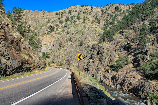
Notice how steep and rocky the canyon is!  There's very little soil on those slopes to absorb rain, so heavy rain quickly fills the river.  That's what happened in the big floods in 1976 (America's deadliest flash flood, 143 killed) and 2013.

Big Thompson Canyon Estes Park Colorado geology travel trip fieldtrip Rocky Mountains flood copyright RocDocTravel.com
The canyon widens in a few places, like here west of the series of goosenecks.  It's the same schist and gneiss bedrock.

Big Thompson Canyon Estes Park Colorado geology travel trip fieldtrip Rocky Mountains flood copyright RocDocTravel.com

Viestenz-Smith Mountain Park has information about the big flood of 1976, and it's a pleasant place to stretch your legs and enjoy the river.  It's located here:  40.419132, -105.281760


Big Thompson Canyon Estes Park Colorado geology travel trip fieldtrip Rocky Mountains flood copyright RocDocTravel.com
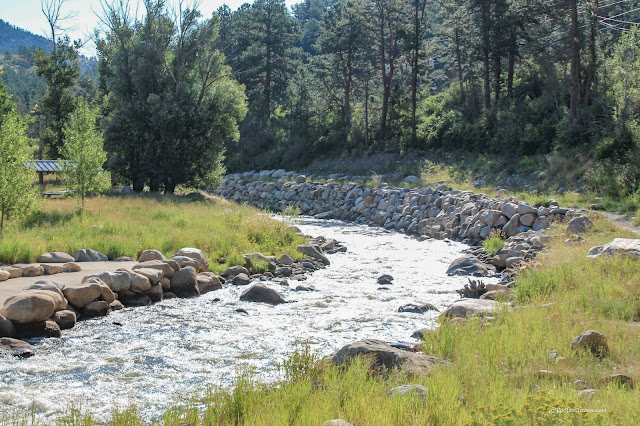
The riverbanks have been armored with rip-rap (blankets of boulders) to reduce erosion.  Outside bends like the one shown here are particularly vulnerable to erosion during floods.

Big Thompson Canyon Estes Park Colorado geology travel trip fieldtrip Rocky Mountains flood copyright RocDocTravel.com
This sign at the site of an old hydroelectric plant describes the flood in 1976 and 2013.

Big Thompson Canyon Estes Park Colorado geology travel trip fieldtrip Rocky Mountains flood copyright RocDocTravel.com
Remnants of the old hydroelectic plant.

Big Thompson Canyon Estes Park Colorado geology travel trip fieldtrip Rocky Mountains flood copyright RocDocTravel.com
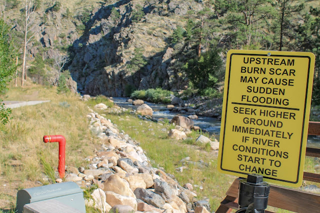
Flood warning signs are placed throughout the canyon.  The reason this canyon is so prone to flash floods is the impermeable metamorphic bedrock and its large drainage area in the Estes Park area, which can collect a tremendous amount of rainfall.

Big Thompson Canyon Estes Park Colorado geology travel trip fieldtrip Rocky Mountains flood copyright RocDocTravel.com
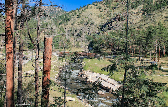
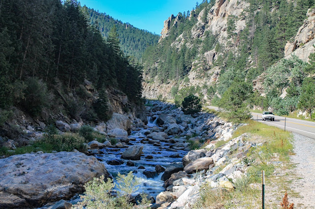
This stretch of Big Thompson shows the armored riverbanks.  Previous flood levels are visible (a little higher than the highway) where older vegetation was stripped away.

Big Thompson Canyon Estes Park Colorado geology travel trip fieldtrip Rocky Mountains flood copyright RocDocTravel.com
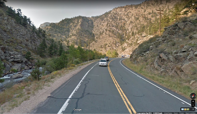
This Street View image was taking in 2012, before the 2013 flood.  The highway here was close to the river, and was destroyed.  The next picture is the new highway just above (to the right) of this spot:  40.425586, -105.293456 

Big Thompson Canyon Estes Park Colorado geology travel trip fieldtrip Rocky Mountains flood copyright RocDocTravel.com
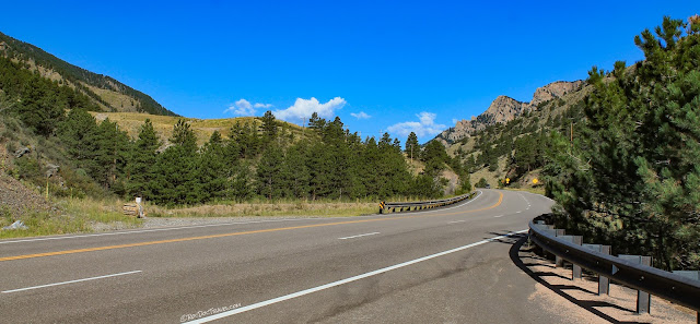
US highway 34 had to be rebuilt in many places after the 2013 flood, including this spot where it was moved higher away from the river, and a new roadcut was made (at the far end of the road in this picture) to avoid following around the river's gooseneck.

Big Thompson Canyon Estes Park Colorado geology travel trip fieldtrip Rocky Mountains flood copyright RocDocTravel.com
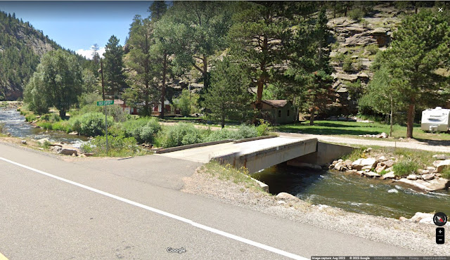
Here's a recent view of Rock Canyon Road.  This video shows this spot during the 2013 flood:  link

Big Thompson Canyon Estes Park Colorado geology travel trip fieldtrip Rocky Mountains copyright RocDocTravel.com
The canyon opens up at Estes Park, and the first thing you see is this big earthen dam for Lake Estes.  Rocky Mountain National Park is in the mountains in the right distance.

Big Thompson Canyon Estes Park Colorado geology travel trip fieldtrip Rocky Mountains copyright RocDocTravel.com
Estes Park is beautiful, surrounded by high Rockies peaks.  The bedrock here is similar to Big Thompson canyon.

Big Thompson Canyon Estes Park Colorado geology travel trip fieldtrip Rocky Mountains copyright RocDocTravel.com
This is Big Thompson creek in Estes Park above Lake Estes.

Big Thompson Canyon Estes Park Colorado geology travel trip fieldtrip Rocky Mountains copyright RocDocTravel.com
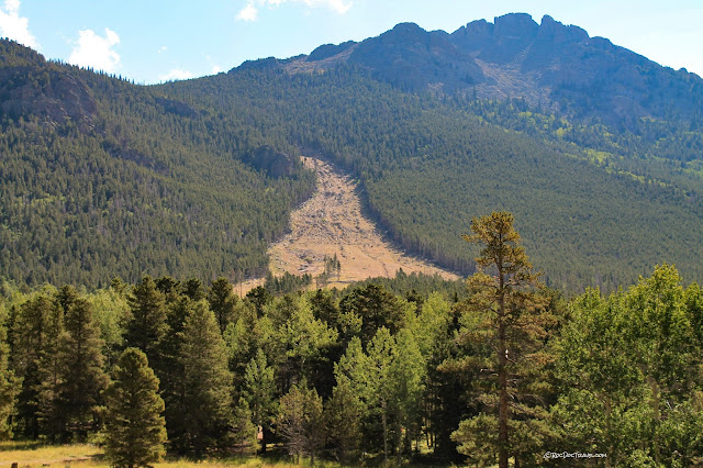
I found this big avalanche scar south of Estes Park, where snow (and probably a lot of mud and rocks) recently stripped out the forest.

Geology of Mt. Evans

America's Highest Paved Road at 14,130 ft.

Mt. Evans road is accessible to any vehicle whose brakes and radiator are in good condition, but I don't advise taking any RV's up the steep, winding road.  The high elevation also weakens combustion engines, so expect your vehicle to be a bit sluggish.

Mt. Evans Colorado geology travel trip fieldtrip Rocky Mountains copyright RocDocTravel.com
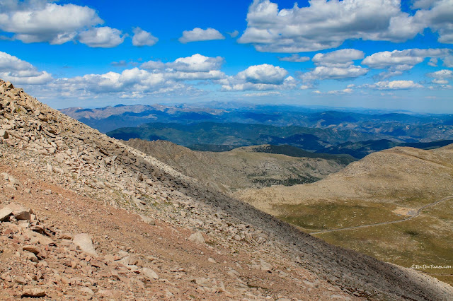
All along the way, you'll have amazing views over the Rockies.

Mt. Evans Colorado geology travel trip fieldtrip Rocky Mountains copyright RocDocTravel.com
The Mt. Goliath Natural Area has a little visitor center and great scenic views.  It's located here:  39.642924, -105.592791

Mt. Evans Colorado geology travel trip fieldtrip Rocky Mountains copyright RocDocTravel.com
Here's a warning: The road has extremely bad pavement!  Low sports cars will have a terrible time scraping along here.  Hopefully by the time you visit, the state will have repaved.  

Mt. Evans Colorado geology travel trip fieldtrip Rocky Mountains copyright RocDocTravel.com
The high elevation and its frequent freeze/thaw cycles is very hard on pavement and structures.

Mt. Evans Colorado geology travel trip fieldtrip Rocky Mountains copyright RocDocTravel.com
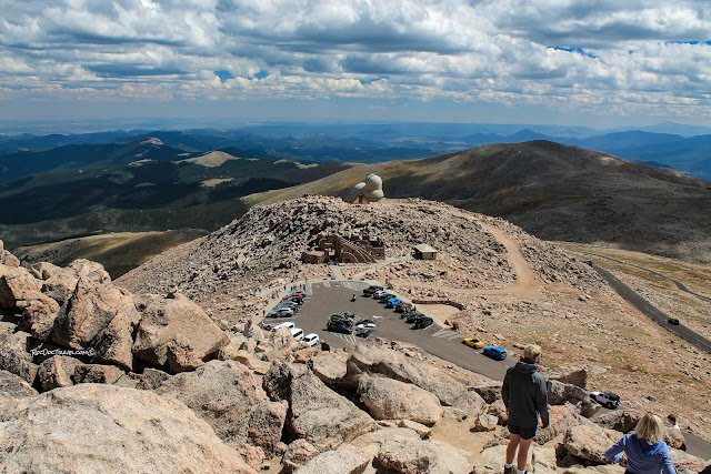
This is the parking lot at Mt. Evans, and that pile of boulders is the peak.

Mt. Evans Colorado geology travel trip fieldtrip Rocky Mountains copyright RocDocTravel.com
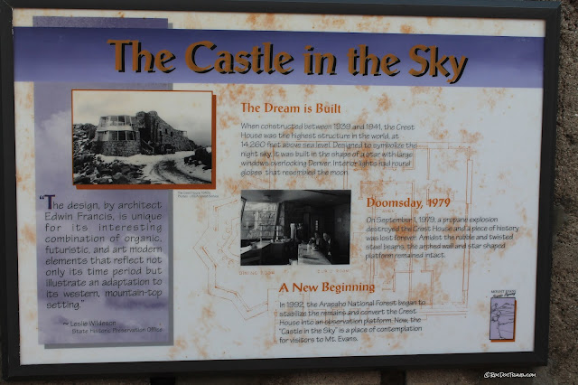
I was surprised to find this old stone building at the top parking lot.  It was someone's pretty great idea to build a restaurant at "the top of the world," but...

Mt. Evans Colorado geology travel trip fieldtrip Rocky Mountains copyright RocDocTravel.com
... it was destroyed in a propane explosion in 1979.  I'm kinda sad it was not rebuilt. It's now an observation area.  Don't be surprised to see mountain goats nearby!

Mt. Evans Colorado geology travel trip fieldtrip Rocky Mountains copyright RocDocTravel.com
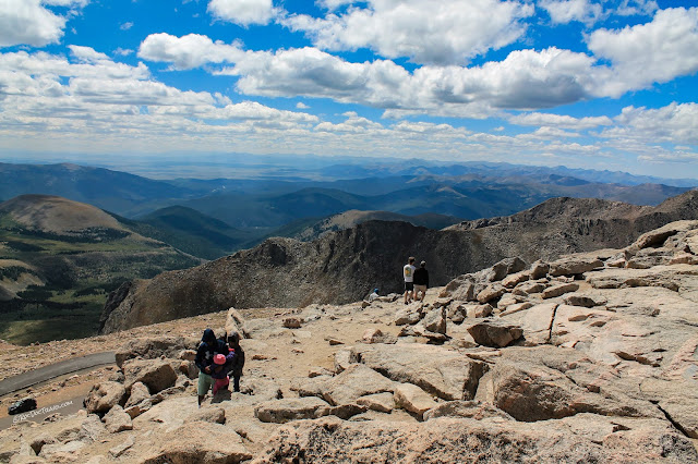
Looking north from the observation area.

Mt. Evans Colorado geology travel trip fieldtrip Rocky Mountains copyright RocDocTravel.com
View of the peak from the observation area.

Mt. Evans Colorado geology travel trip fieldtrip Rocky Mountains copyright RocDocTravel.com
Mountain goats!

Mt. Evans Colorado geology travel trip fieldtrip Rocky Mountains copyright RocDocTravel.com
Good place for a selfie, overlooking the mountains and way out to Denver.

Mt. Evans Colorado geology travel trip fieldtrip Rocky Mountains copyright RocDocTravel.com
Mountain goats!

Mt. Evans Colorado geology travel trip fieldtrip Rocky Mountains copyright RocDocTravel.com
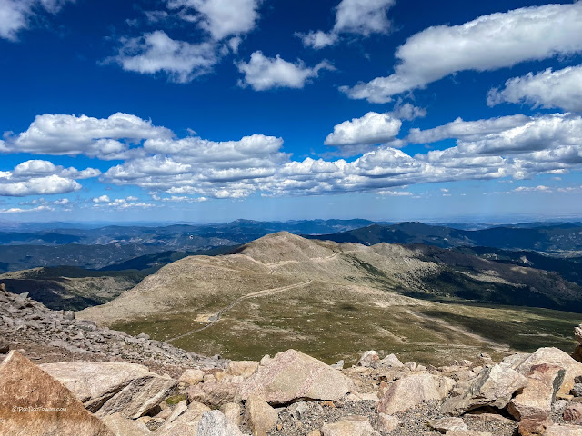
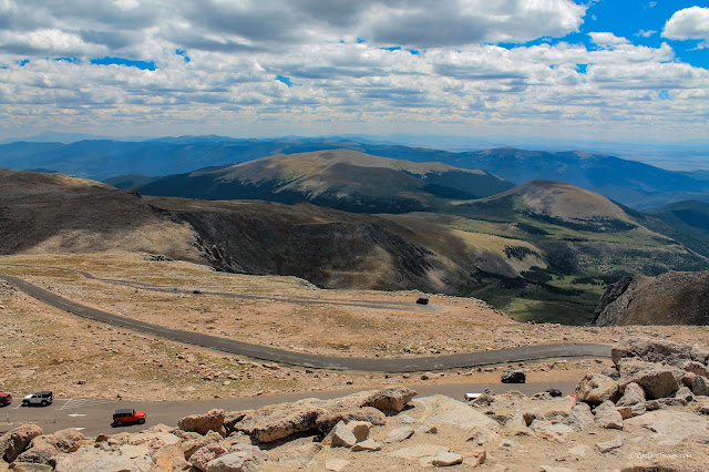
View northward from the peak.  You can see the winding road.

Mt. Evans Colorado geology travel trip fieldtrip Rocky Mountains copyright RocDocTravel.com
Looking southward toward the big intermontane basins on the middle fork of the Platte River.

Mt. Evans Colorado geology travel trip fieldtrip Rocky Mountains copyright RocDocTravel.com
From the peak looking east at the observation area and parking lot.

Mt. Evans Colorado geology travel trip fieldtrip Rocky Mountains copyright RocDocTravel.com
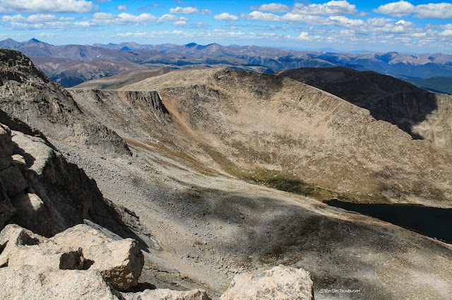
The north side of Mt. Evans was glaciated, forming cliffs in these cirques.

Mt. Evans Colorado geology travel trip fieldtrip Rocky Mountains copyright RocDocTravel.com
USGS survey marker at the top of the peak elevation 14,258 feet

Mt. Evans Colorado geology travel trip fieldtrip Rocky Mountains copyright RocDocTravel.com
View southeast toward Pike's Peak.

Mt. Evans Colorado geology travel trip fieldtrip Rocky Mountains copyright RocDocTravel.com
View north to Summit Lake.

Mt. Evans Colorado geology travel trip fieldtrip Rocky Mountains copyright RocDocTravel.com
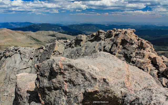
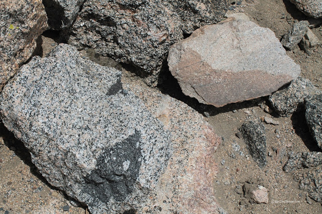
These are the rocks of the peak.  See the pink pegmatite dikes?

What is that bedrock?

Mt. Evans Colorado geology travel trip fieldtrip Rocky Mountains copyright RocDocTravel.com
Mt. Evans is part of a granitic batholith, which is a large exposure of granite made of many individual plutons, like the blobs of wax gathered in the top of a lava lamp.  The dark rock here is a xenolith ("foreign rock") of older rock that fell into the granite magma.  The lighter pinkish rock is aplite, a granite named for its finely crystalline "apple" texture.

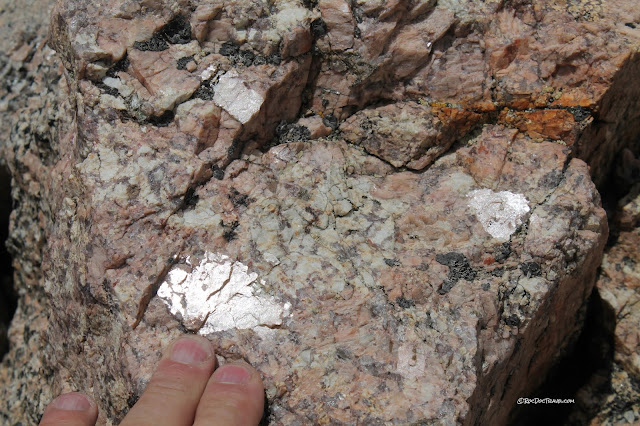
The minerals in granite are quartz (glassy or gray), feldspar (opaque white or pink), biotite (shiny black plates), and amphibole (black, kinda rectangular).  Much of the granite here is porphyritic, which means some of the minerals (typically feldspar) are much larger than the rest.

Mt. Evans Colorado geology travel trip fieldtrip Rocky Mountains copyright RocDocTravel.com
Another variety of granite here is pegmatite, which I like to call "minerals of unusual size (MOUSs).  The reflective ones here are orthoclase feldspar

Mt. Evans Colorado geology travel trip fieldtrip Rocky Mountains copyright RocDocTravel.com
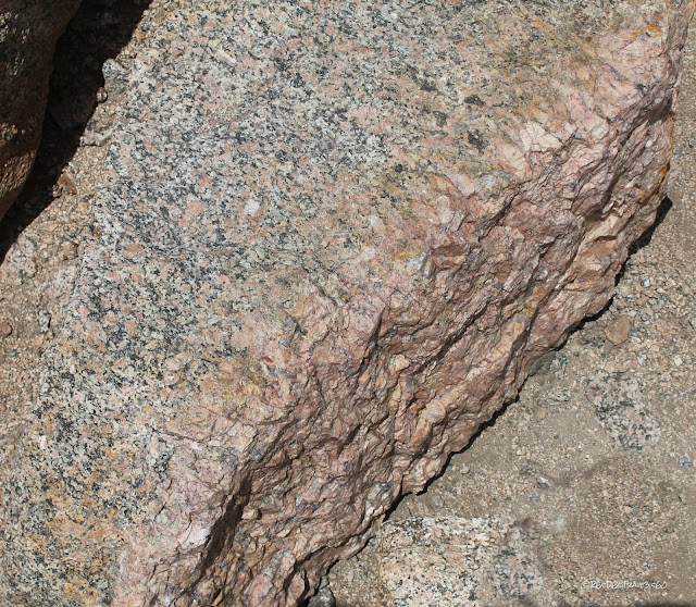
Here's a narrow pegmatite dike with a lot of pink orthoclase feldspar.

Mt. Evans Colorado geology travel trip fieldtrip Rocky Mountains copyright RocDocTravel.com
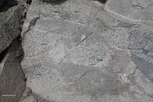
While the granite is still molten and moving, magma pockets of different composition flow and mix together, like here where a lighter colored, finer textured granite flowed in and around the speckled granite.

Most Popular Posts

The San Andreas Fault: I-15 to I-5

Mouth of the Columbia River