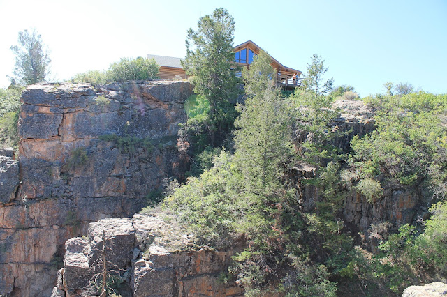
Ouray, Colorado and the Million Dollar Highway, and Black Canyon of the Gunnison National Park
Black Canyon National Park & Million Dollar Highway, Colorado
Explore Black Canyon of the Gunnison National Park and the Million Dollar Highway in Colorado's gorgeous San Juan Mountains!Why Visit? Black Canyon of the Gunnison is deeper and narrower than the Grand Canyon's inner gorge, and boasts fantastical bedrock cliffs. The bedrock here displays 1.7 billion years of North America's history! It's narrower and deeper than any other canyon in North America!
Travel: Most people drive their own vehicles to these gorgeous places, but flight options are available to nearby Durango, Cortez, Montrose, and Four Corners Regional Airport in Farmington, New Mexico. This is a good place to have an off-road vehicle, as some of the most amazing back-country trails in the country wind through the San Juan Mountains. RVs can do all right on the Million Dollar Highway, but make sure your vehicle is in top mechanical condition, especially the brakes.
Seasons: These are largely spring - summer - fall destinations, but local winter sports are legendary. Snow is heavy in the winter, and first-rate ski resorts are available at Telluride and Purgatory, and smaller hills at Silverton and Hesperus (west of Durango). Cross-country skiing and snowmobile trails are also numerous.
Lodging: In addition to Forest Service and private campgrounds scattered throughout the area, motels are available in Ouray, Telluride, Durango, and Silverton. For Black Canyon, closest lodging is in Delta, Montrose, and Gunnison. For this trip, I stayed in Gunnison and in Durango and fell in love with both towns. I was blown away by the great restaurants!
Geology of Black Canyon of the Gunnison National Park
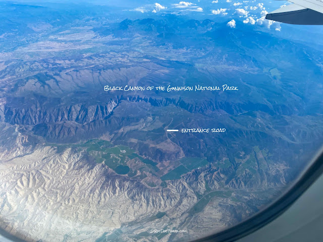
Here's Black Canyon from the air, looking north. This view shows how the river crosses a plateau just like the Grand Canyon does. That strangeness took Geologists decades to figure out! Keep reading...
When you enter the park, I recommend going all the way to the west end and working your way back eastward. This works in most national parks to avoid following the crowds (although this park never gets crowded!).
Black Canyon sits on an uplifted plateau, with views like this westward over the Uncompagre River valley, where Montrose and Delta are located.At the west end, you can see the plateau dropping down toward the valley. Like the Grand Canyon, Black Canyon exists because the river was already here when the land slowly rose about 5 million years ago. It was easy for the river to erode 1-2 mm per year to maintain its stable profile, very gradually cutting the canyon. The land rose around the river!
The dark bedrock is mostly Proterozoic granites, with gneiss and a black rock called amphibolite in places. These rocks are over a billion years old!
From the Dragon Point viewing area: See the dragons? They're made of pinkish pegmatite (see the next picture) cutting through the granite. These dikes followed (and sometimes created) fractures, and solidified in place.
For comparison, Black Canyon is as deep as the Burj Khalifa (Dubai) is tall!
Looking eastward from Chasm View, you start to see some different bedrock and pervasive fractures. See more below.
The Great Unconformity is an erosional surface across North America on which up to two billion years of Earth's history has been washed away! Other continents have similar aged unconformities. The rocks below include the dark 1.7 billion year old metamorphic rocks, 1.4 billion year old granites, some 500 million year old dikes, while the thin Entrada sandstone above it is about 165 million years old -- a difference of 435 million to over 1.5 billion years! The Entrada is lithified dunes, formed in a broad sandy desert.
The Proterozoic rocks have been intensely folded and faulted during early continental collisions, resulting in vertical layering throughout the canyon. The cross-section above passes through this point, from Pulpit Rock overview.
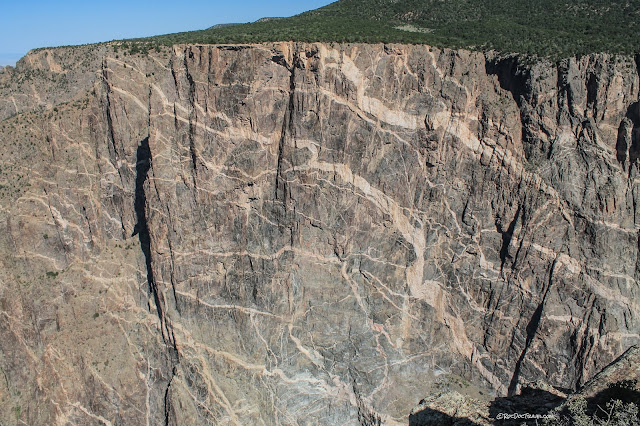
The steep fabrics of the Proterozoic bedrock show layering between gneisses (grayish), amphibolites (black), granite dikes (whitish), and pegmatite dikes (pink).
Looking eastward. Notice how the granites and metamorphic rocks are planed off flat, and overlain by much younger horizontal Jurassic sedimentary rocks. That planing off took place about 305 million years ago when North America's southern edge collided with South America and Africa.
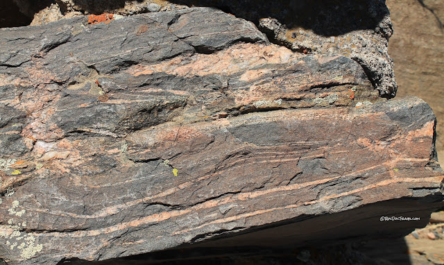
Scattered around the viewing areas are beautiful pieces of the bedrock, like this banded & folded gneiss. The deformation of these rock layers all took place in the solid state under high pressure -- no melting!
Here's a look at one of the view areas, Gunnison Point, and the canyon behind. Look how narrow the canyon is!
Imagine rock layers that were originally horizontal being squeezed under tremendous pressure until they fold up like blankets being pushed across a bed! Like the cross-section above shows, these layers are part of tight folds resulting from continents colliding.
You'll get some spectacularly verticle views down into this amazing canyon!
Geology of the Million Dollar Highway, U.S. 550
Ouray to Molas Pass
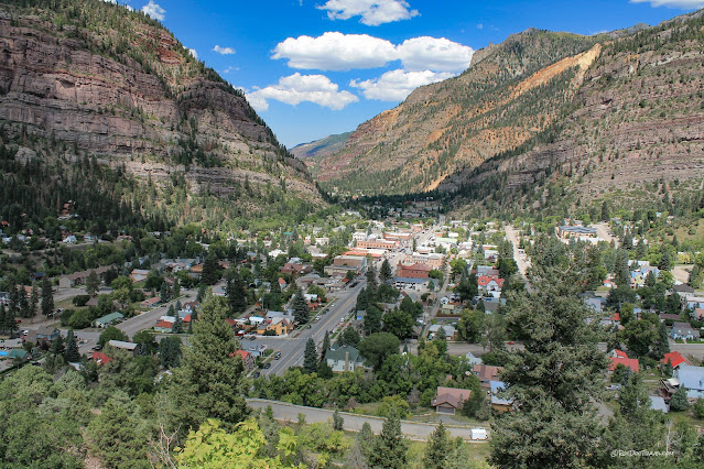
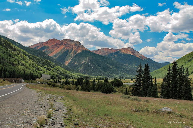
You'll fall in love with Ouray! It's a transformed mining town nestled in a small canyon where the Uncompagre River carved out scenic cliffs of layered sedimentary rocks -- sandstone, siltstone, shale, a little limestone, and conglomerate. They are about 310 million years old in the lower slopes and about 30 million years old volcanic rocks in the high peaks. They were deposited in the Uncompagre basin from uplifts to the east (related to the Ancestral Rockies orogeny).Past Ironton, you'll go up some switchbacks, where you get this view of the amazingly colorful San Red Mountain, which is over 12,000 feet high.
As the highway winds higher and higher, you'll pass through mining districts that boasted some very rich mines.
From the Red Mountain overlook, you can see a headframe (the reddish structure in the distance) of the Yankee Girl mine. It operated from 1882 to 1989 with shafts and 25 miles of tunnels as deep as 1200 feet below the surface, producing silver, gold, and copper. The headframe housed the elevator lifting wheel & mechanism. Some of the silver ore was so pure, it went straight to the refinery as-found! The mine produced over $8 million in metals, worth over $100 million today.
Keep your head on a swivel as you go up Red Mountain pass! The mountains to the west are sedimentary rocks, while everything colorful to the east is volcanic.
South of Silverton, the Million Dollar Highway again climbs, this time on spectacularly layered sedimentary rocks (sandstone, siltstone, shale, conglomerate, a little limestone). You'll pass beautiful Molas Lake (in the distance) on the way up to Molas Pass. The bedrock in the lowlands to the right (east) are Precambrian rocks like those in Black Canyon. The high peaks in the distance are the San Juan volcanic field.
At the Molas overview, you can see the Devonian to Jurassic sedimentary bedrock layers. At this high elevation, the entire landscape was scraped and smoothed by thick glaciers during the Ice Age, creating this unique terrain with steep peaks and spotty lakes.
