Awesome Crater Lake
Crater Lake National Park
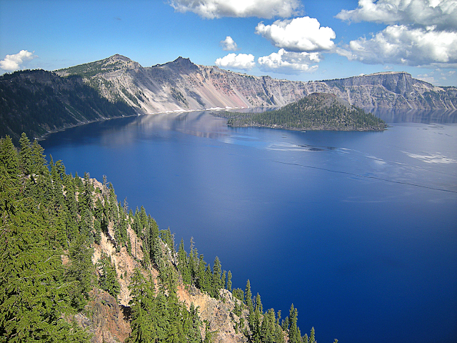
Go see the world's most beautiful caldera, Crater Lake, Oregon!You can't see any hint of the lake until you get right to the rim, and then...
...Wow! Crater Lake is one of those places you simply have to see to believe. No photo or video can do it justice!
Why Visit Crater Lake?
If you think the pictures are inspiring, wait until you see it in person! Crater Lake is simply one of the most awesome, beautiful, inspiring, and stunning places you will ever visit. And bonus: it's a fascinating geological site!Crater Lake is unique because it cannot be seen except from right at the caldera rim. Though explorers, trappers, settlers, and gold prospectors had been in this region for decades, it wasn't until someone climbed up here that Crater Lake was finally discovered (at least by the white men). To this day, the sudden appearance of a huge and breath-taking lake in the mountains is a wonderful surprise for every visitor.
Travel to Crater Lake
Time: At least a day, more if you want to hike or take a boat tour. Take time to soak it in!When To Go: If you can, visit twice -- once in winter through May while snow still caps the caldera rim, and once later in summer or Fall when you can see the bedrock. And remember that bad weather only makes the views more beautiful. The road to Rim Village is open all year, but the west rim road and north entrance are closed in winter.
Difficulty: Easy. You can see a lot from Rim Village and the several turn-outs along the west rim road. Short and long hikes are also available.
Vehicles: Any. The road to Rim Village does have some steep spots, so be sure your RV and its brakes are in good condition. Road Conditions
Facilities: Full facilities at Rim Village, including lodging. Camping available in the park. Park website
Boat tours around the lake and to Wizard Island are available, and highly recommended! They'll even show you "Phantom Ship," an eroded patch of volcanic rocks towering out of the water on the south side of the lake.
Interactive Google Map
Geology of Crater Lake
Mount Mazama erupted 7,700 years ago in one of the biggest Cascades eruptions we know of -- 116 cubic kilometers of ash, compared to Mt. St. Helens' 1980 eruption's <1 cubic kilometer. Pyroclastic flows (hot avalanches of ash and gas) traveled down the mountain slopes at over 125 miles per hour and out as far as 70 km (43 miles). The massive eruption put 2 inches of ash on the ground 1000 km (625 miles) away in the Midwest and Canada. You can still find Mazama ash in Nebraska! Earth has not seen an eruption that big in the past 2000 years. And Crater Lake is still considered a potentially active volcano -- it definitely could erupt again!Mt. Mazama was likely a high and massive peak like the other Cascades volcanoes -- think of Mt. Rainier, but maybe bigger. The peak could have been over 15,000 feet high -- there's no way to know for sure. But we do know that it was glaciated because of the U-shaped valleys that remain on its lower slopes (see my pictures below). You'll see artist's renditions of Mazama in the park.
Look for this sign at a lake overlook showing how massive Mt. Mazama was. (NPS picture)
A caldera forms when an eruption is so big, it empties the magma chamber below, and the volcano collapses into the void. The caldera shows how big the magma chamber was -- and this one was huge! But collapse of a caldera is not the last of the eruptions. Most calderas eventually fill in with new lava flows and volcanoes, like Yellowstone has. Maps of the lake floor show those volcanoes, including the tallest of them, Wizard island. More may form in the future.
(Above) Bathymetry of Crater Lake shows the volcanoes that lie there out of sight. The deepest part is 1946 feet (593 meters) in the northeastern corner, making it the deepest lake in the U.S. and 10th deepest in the world. (USGS picture)
(Above) This diagram is a cross-section through Crater Lake, showing the volcanoes that have formed since the caldera collapsed. (USGS)
*** See my "Volcano Primer" page to learn the rock types and features found at volcanoes.
(Above) This U-shaped valley on the south rim was formed by a large glacier coming off the peak of Mt. Mazama before the eruption. Judging by the width and depth of the valley, the mountain must have provided a very large area of snow accumulation, meaning a high and massive peak.
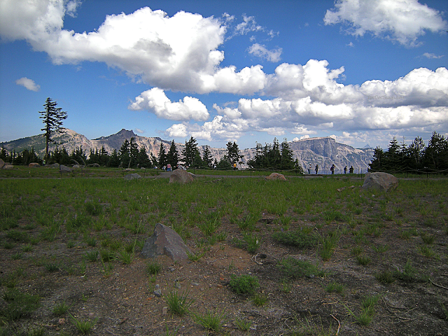
(Above) The rim is one continual round of breath-taking scenery.
(Above) On this visit in late May, I encountered more than 15 feet of snow! Winter is a beautiful time to visit - your camera will love it!
(Above) Wizard island is a basaltic cinder cone that rises 755 feet (230 m) out of the water and 2700 feet above the caldera floor. It formed at least 800 years ago, and is just the top of a broader volcano sitting on the caldera floor. On the north rim (marked in green) is a thick lava flow that filled one of the U-shaped glacial valleys before the caldera eruption. It may have melted a glacier, causing a massive flood down the river below.
(Above) Wizard Island from one of the turn-outs. Great views are so easy to get to!
(Above) This view of the north rim was taken from close to one of the Rim Drive turn-outs. It shows the thick lava flow that filled the U-shaped valley long ago.
Follow your fancy... savor... contemplate... enjoy!
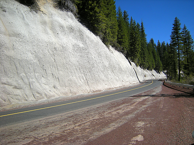
(Above) The Mazama ash is exposed in many places, including this road cut on highway 230 west of the park. Take a hand lens or magnifying glass to see the rock fragments, pumice, and mineral fragments in the ash. 42.984214, -122.398120
Web Links:
Crater Lake National Park: http://www.nps.gov/crla/index.htm
The Park on Facebook: https://www.facebook.com/Crater-Lake-National-Park-137127376328525/
Incredible night photo of the Milky Way over Crater Lake: http://apod.nasa.gov/apod/ap130619.html
Brief summary USGS article on the Mazama caldera eruption: http://volcanoes.usgs.gov/volcanoes/crater_lake/crater_lake_geo_hist_135.html


