25 Cool Geology and Landscape Photos
25 (or so) Cool Geology and Landscape Photos
 A A curious traveler at 10,100 feet in the Lemhi Mountains of central Idaho. The high slopes and valleys were glaciated in the last ice age. The near bedrock is Paleozoic continental shelf limestone, silt, and shale. The far mountains are Eocene (about 40 million year old) volcanic rocks.
Wherever I travel, I take a lot of pictures. Not all of them fit into any particular field trip, so it occurred to me to post them in a "trip" of their own!
There's not a lot of rhyme or reason to these, except that this batch is all from the western U.S., so here goes!
Mining ghost town near Georgetown, Montana in the Flint Creek Mountains. Sapphires are mined in the area, but these mines mostly produced gold, copper, and silver.
A "mansion" at Nevada City, southern Montana. Gold dredge mining brought a boom to this area beginning in the 1860's, and by the 1920's over $2.5 billion had been taken out of here and nearby Virginia City.
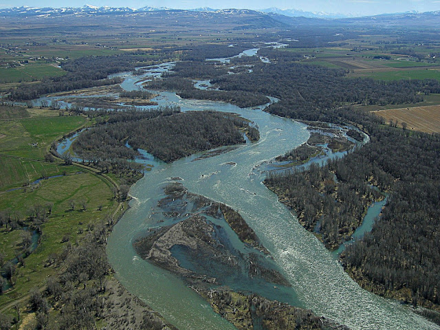
The Snake River emerging from the mountains out onto the Snake River Plain in eastern Idaho, which is the Yellowstone hot spot track. The river has a fascinating course across very different terrains -- glaciated volcanic rocks at Yellowstone, through a glaciated valley at Jackson Hole, across a mountain range at Hoback, through a faulted graben at Swan Valley, across the volcanic Snake River Plain, through deep canyons carved by an enormous ice age flood from Lake Bonneville, and through the West's deepest canyon at Hell's Canyon. What a river!
The Snake River heads out onto the plains near Ribgy, Idaho. On the left skyline you can see a cinder cone that erupted into the river, tossing gravel into the air along with the lava. The Menan Buttes will be an upcoming field trip.
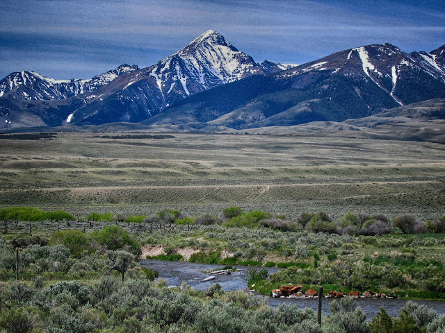
Diamond Peak in the Lemhi Range and Birch Creek. The peak is Idaho's 3rd highest at 12,200 feet. It is composed of Paleozoic limestone that formed on the continental shelf and was later shoved landward by tectonic collisions.
High water in the Teton River floodplain in May near Rexburg, Idaho. The long-term, geologic floodplain is usually easy to spot - look for the relatively flat area around the river enclosed by bluffs or cliffs. The bluffs here are about 8 feet tall, and that makes all the difference in flood hazards.
The valley of Dillon, Montana, with the gorgeous Tobacco Root Mountains in the distance. This valley is part of the Basin and Range geologic province that is actively extending east-west. Dillon experienced a magnitude 5.6 earthquake in July 2005 that damaged some buildings. The epicenter was near the center of this picture.
Cabins at Quartz Hill mining ghost town in the Pioneer Mountains of southwestern Montana. The area produced silver, lead, zinc, and copper from the late 1860's to the 1960's. The mountains have gorgeous glaciated valleys and a core of visibly folded granite.
The DL ranch west of Dillon, Montana has an idyllic setting.
Trout in the Henry's Fork river at Big Spring, Idaho. The spring emerges from the base of a thick obsidian flow out of the Yellowstone caldera and onto the Island Park caldera. Ice age lake sediments in Island Park form a seal that the groundwater can't get through, forcing it out at Big Springs. See my post on Island Park, Idaho for more.
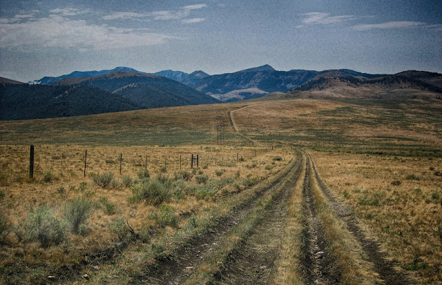
Continental divide road at Bannack Pass between Idaho (left) and Montana (right). This pass is the only dirt road that crosses the state line at Montana's southern border. The only other crossings are I-15 and U.S. 20 to the east and highway 29 to the northwest.
Me and my big redwood friend in Humboldt Redwoods, northern California. You have not lived until you've strolled through the redwoods! Did you know these trees are nearly fireproof, and hold each other up by their root systems?
Bear Lake Valley, northern Utah, is a graben (down-dropped valley) in the Basin and Range geologic province. The straight mountain front on the far side of the valley was formed along a normal fault that is still seismically active.
The Maybe phosphate mines in southeastern Idaho. Mines throughout this region take phosphate deposits out of the aptly-named Phosphoria Formation, which is Permian in age. The phosphate formed in shallow seas under unusual conditions.
A cove in Palisades Reservoir in eastern Idaho. The reservoir fills a valley between two normal faults, but don't worry - the dam is not near them, and was built to withstand earthquakes.
Fractured cobbles and boulders in the Beaverhead Conglomerate, southwestern Montana near Lima. This Cretaceous alluvial fan complex was crushed when a thick mountain range was thrust on top of it. The fractures you see in these rocks tell of the crushing.
After a wildfire near McCall, Idaho.
A burned forest north of McCall, Idaho, a few years after a devastating fire. The bedrock is Cretaceous granite that geologists call a "batholith," meaning a very large exposure of igneous rock. The granite formed above a subduction zone when an ancestor of the Pacific plate was sinking under the North American plate. That sinking results in formation of vast quantities of magma and of course volcanoes, like at the Andes and Cascades mountains. The granite is magma that never erupted, instead crystallizing underground. The volcanoes that once sat above the Idaho Batholith have long since been eroded away, leaving only their roots.
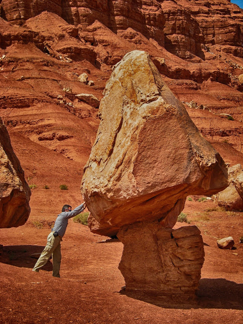
Balanced rocks south of Kanab, Utah. They form when the softer siltstone below erodes away, leaving the harder sandstone stranded above.
Where is Wile E. Coyote when you need him?
A summer squall south of Leadore, Idaho. This area had a mining boom in the 1880's and 1900's, but like all mining booms those didn't last. Sporadic activity has taken place ever since, including some prospecting in the 2010's.
Summer rainbow, Big Hole Mountains, eastern Idaho. These mountains are part of the Cretaceous thrust belt in which the continental margin was compressed and thrust landward, forming these folds and tremendous thrust faults. It was more recently uplifted as part of the Basin and Range crustal extension that is still ongoing in the West.
The road beckons! Early July in the Big Hole Mountains of eastern Idaho. The red dirt is part of a conglomerate that formed as alluvial fans in front of the growing Cretaceous thrust belt mountain range.
Cabin, Lemhi Mountains, Idaho. The cabin sits in a glacial cirque - a semicircle of cliffs formed at the head of a glacier. Cirques often have a relatively flat, scenic floor like here, or they can hold lakes.
Colorado River south of Page, Arizona. An ancestor to the Colorado River used to flow northward here, but was captured by the Colorado and turned around. The river is in deep canyons because the region was slowly uplifted about 5 million years ago, and the rivers easily eroded back down to their stable profiles closer to sea level. As a result, the Colorado flows from the shallow canyon here into the deeper canyon in the high plateau of the National Park - a seeming impossibility.
Geology Students working in the Caribou Range of eastern Idaho, part of the Cretacous thrust belt.
Golden Gate bridge towers poking through the fog, San Francisco, California. San Francisco is built on old subduction zone rocks that are intensely folded and faulted, and are prone to landslides.
I'll post random pictures like this again occasionally.
I'll post random pictures like this again occasionally.


