Grand Canyon: South Rim and Bright Angel Trail
Grand Canyon South Rim
and Bright Angel Trail
Caution: Visiting the Grand Canyon will make you want to move out West and become an explorer and photographer!
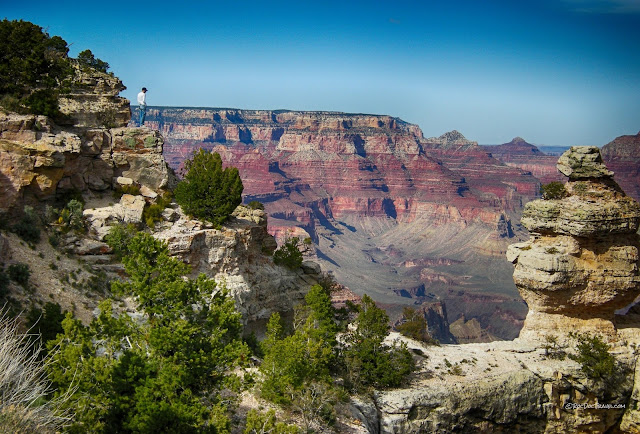
A geologist enjoys the view of the Grand Canyon from along Desert View Drive.
Travel to the Grand Canyon
Why Go: The Grand Canyon is one of the great natural wonders of the world. The colorful vistas alone will stay with you forever, but once you understand the deep Geologic history on display here -- which most people don't see -- you will live in utter awe and amazement that you got to experience something so profound and Grand!Time: Depends on how much you hike. Spend at least 2 days at the South Rim if you're not hiking.
Effort: From easy to as difficult as you want to make it by hiking.
Facilities: Lodging, camping, RV parks, food, gifts, groceries, and more at Grand Canyon Village and Tusayan. I don't advise staying any farther away.
Seasons: The South Rim is open all year, but some facilities are limited, so check the park's website HERE. The North Rim is closed in winter (it's at 8000 feet!). I've camped on snow and hiked on ice at the south rim (late March and April), which had its own unique appeal, but you will enjoy Spring and Fall best. The south rim is 7000 feet (2130 m) elevation, so it doesn't get that hot in summer, BUT the lower canyon is a furnace, and so hiking to the river and back in a day is not advised in mid-summer. See the park's cautions about hiking HERE.
Groups: The park limits hiking groups to about 11 people, so check with them while planning.
Interactive Google Map of the Grand Canyon area.
Grand Canyon Geology
The Big Geologic Picture Most People Miss:The Grand Canyon story really starts a hundred miles north in southern Utah near Cedar Breaks and Bryan Head national parks. The sedimentary rock layers exposed in the cliffs in the Utah national parks used to extend southward across the Grand Canyon area. Over time, uplift at the Grand Canyon caused erosion to wash away the younger layers that used to be on top. They eroded away layer by layer, and their exposed edges -- cliffs -- have retreated northward into Utah mile by mile away from the Colorado River and its tributaries. The cliffs form giant stair-steps from Cedar Breaks to Zion to the Vermillion Cliffs at Kanab, to the Grand Canyon's upper (Kaibab) cliffs, and down to the inner gorge cliffs. All that rock washed down the Colorado River. We can call each set of cliffs the Cedar Breaks (highest), Zion, Vermillion Cliffs, and Grand Canyon.
(Above) The Grand Canyon has the lowest set of cliffs in the "grand staircase." Younger rocks that once extended across the Grand Canyon have been eroded off, and their cliffs have retreated northward into Utah.
This is the view looking south from the Cedar Breaks cliffs down on top of Zion National Park, the highest two of the cliff levels of the "grand staircase." The Grand Canyon is not quite visible, but would be in the far left distance.
View northward from the Kaibab uplift north of the Grand Canyon into southern Utah.
No matter what direction you approach the Grand Canyon from, note that you will go uphill to get there. The south rim is up to 7400 feet (2255 m) and the north rim is over 8000 feet (2440 m) in elevation! Now doesn't that raise an interesting question about the river? Why does the river flow into the uplifted area, instead of off from it? What in the world is it doing, flowing through the middle of a high uplift?
The answer is delightfully simple: the river was there first! A river has the ability to erode downward faster than tectonics can lift the land upward. That's why all tectonically active mountain ranges have deep canyons in them (Himalaya, Sierra Nevada, Andes, Tetons, etc.). Several million years ago, the Grand Canyon region started to be uplifted. At only a few millimeters of uplift per year, the Colorado River had no problem eroding downward, essentially staying at the same elevation. And so while the land uplifted by a mile, the river stayed at the same elevation -- the land rose around the river!
Throughout this process, the highest rock layers were eroded away one by one until the hard, resistant Kaibab limestone was exposed at the surface where we see it at the top of the Grand Canyon. The main uplift in the park is called the Kaibab uplift, and you can see its eastern edge on the east side of the park.
The Colorado River flows from shallow Marble Canyon in the lowlands into the high Kaibab uplift where the canyon is a mile deep. View is from the northeast along the highway to Page.
The Colorado River flows from the lowlands east and north of the park into the Kaibab uplift. Isn't that amazing, that a river flows into the highlands, not away from them! The fold that caused this uplift is called a monocline, which is a fold with only one tilted panel (or limb). Photo taken from the Desert View area.
Be sure to get to the rim for sunrise and sunset! This is a sunrise view showing Plateau Point with the Bright Angel trail visible on it.
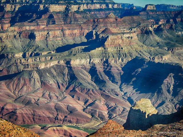
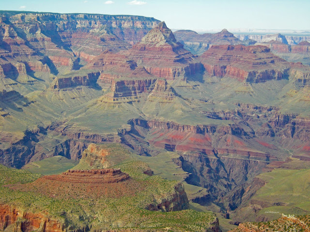
The eastern Grand Canyon certainly is colorful!
The 12,000 foot (3.65 km) thick Precambrian sedimentary rocks in the Grand Canyon are tilted, while younger rock layers are horizontal. That means there was a tectonic event after deposition of the youngest Precambrian layers and the youngest Cambrian layers. The Precambrian layers were then eroded off horizontally, and then the Cambrian Tapeats Sandstone was deposited. The boundary between tilted and horizontal layers is called an unconformity.
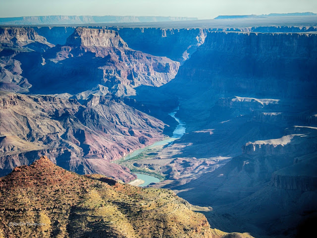
This view shows the Colorado River flowing into the Grand Canyon. The flat area in the distance has elevations of less than 6000 feet, while the rims in the Park are 7000 to 8000 feet elevation. That means the river flows into the highlands!
The Precambrian Grand Canyon Supergroup is the colorful shale layers in the deep eastern canyon. This view shows the Colorado River flowing into the Grand Canyon.
Strata in the eastern Grand Canyon. The orange shale in the lower canyon is part of the Precambrian Grand Canyon Supergroup (see descriptions below). Note that it is tilted, while the younger rocks above are horizontal.
Grand Canyon South Rim
The Rim Trail offers spectacular vistas without being strenuous. I also highly recommend the "Trail of Time" that extends east and west from Grand Canyon Village. It shows you rock samples from all of the formations and describes their history and ages. It's easy for anyone, and very well-done, and is a good preparation for a hike into the canyon.(Above) The National Park Service has done an extraordinary job putting together the fascinating "Trail of Time" trail along the south rim. Don't miss it! (NPS photo)
The Bright Angel Trail: Get and read the information pamphlet HERE. Heed warnings about heat, water, and physical conditioning -- don't take the canyon lightly. Carry and drink more water than you think you'll need -- you will drink it all!
You don't have to hike all the way down to have a wonderful, unique experience. You can hike down just as far as you feel comfortable with, and climb back up at your own pace. The upper mile or so is easy enough for most people. There's nothing like being surrounded by towering cliffs to give you the genuine Grand Canyon experience!
The Bright Angel trail starts in the Kaibab Formation, which is a fossil-rich limestone. Look for fossils along the trail as you descend!
What the website doesn't tell you: To reduce erosion of the trail, the park service has placed logs across the trail on its steep sections, about 7 feet apart. You have to step over the logs and take a slightly longer step than you want to. This is annoying, especially on the way back up when you're worn out, or when the trail is muddy. Soft, comfortable shoes are all I can recommend, because your feet and knees will take a pounding. If it's muddy, make sure you have boots with deep tread soles. An icy trail requires crampons in the upper mile (I've done it -- totally worth it!).
The trailhead is west of the Bright Angel Lodge at the corner of Village Rim Drive and Hermit Road. Parking there is very limited, so unless you get there very early you should take a shuttle.
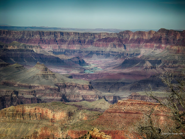
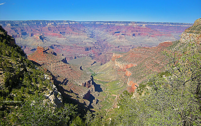
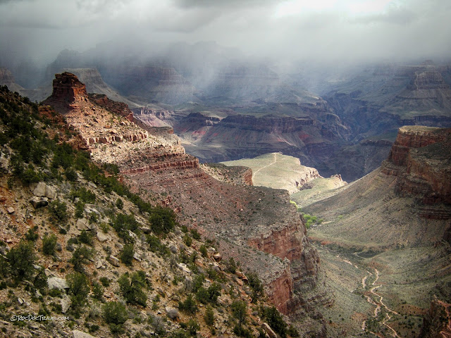
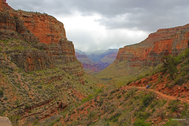
View from near the top of the Bright Angel trail. Erosion along the Bright Angel fault created the two aligned canyons seen here. Plateau Point offers the best wide views of the canyon, and is an easier hike than going all the down way to the river. The trails split at Indian Garden, which is a lovely rest stop with shade and drinking water.
This sunny view looks straight along Bright Angel canyon.
Taken on a different day, this view looks straight along the Bright Angel fault. Erosion along the fault's crushed and weakened rocks created the straight canyons.
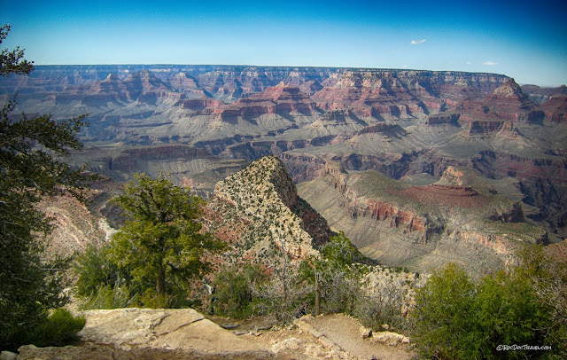
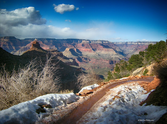
View from near the top of the Bright Angel trail in late March.
View of the canyon from the rim in the summer.
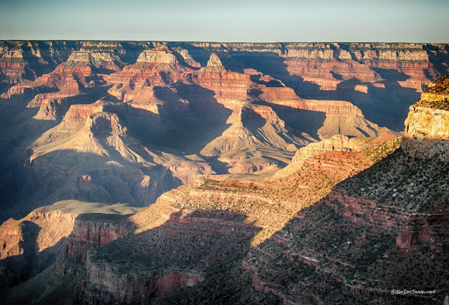
Sunset view from the top of the Bright Angel trail.
Be sure to visit the rim at sunrise and sunset!
Grand Canyon Stratigraphy
To really appreciate the Grand Canyon, you have to have some understanding of those rock layers you're gawking at. Every rock tells a story.Some definitions:
Formation -- a body or layer of rock that is distinct from the layers above or below it. (You will see this word misused on many websites to refer to erosional features.)
Sedimentary Rocks -- sediments like sand, silt, clay, and calcium that have been compacted and cemented (lithified).
Stratigraphy -- the study of rock layers, especially sedimentary rocks.
Depositional Environment -- the type of place the sediments were deposited in. Examples include tidal flats, deltas, shallow marine, deep marine, and so forth.
Ma -- "mega-annum," or million years. 65 Ma means 65 million years ago.
Look at this interactive chart of Grand Canyon stratigraphy: US Geological Survey You can click on formation names and see their descriptions.
To me, the most fascinating thing about sedimentary rocks is the paleogeography they reveal -- that is, they tell us what the geography of this place was when they were deposited long ago. Here is a quick run-down of the Grand Canyon stratigraphy depositional environments, starting at the top of the Canyon (you can follow this list down the Bright Angel trail -- take a copy with you!)
All of the rocks in the Grand Canyon are older than the dinosaurs. To find dino fossils, you have to go northward into the younger strata in Utah and Colorado.
The Kaibab Formation is a white cliff-forming limestone at the rims of the canyon. It was deposited about 270 Ma (Permian) in a shallow sea that deepened toward the west. It contains chert nodules, which are silica deposits that stick out of the rock because they are more resistant to erosion. The Kaibab contains fossils near the top of the Bright Angel trail.
The Toroweap Formation is composed of thin layers of gray to red sandstone and limestone that form thin cliffs and slopes between the thick Kaibab cliffs above and Coconino cliffs below. The limestone weathers dark gray. It is about 273 million years old (Permian), and formed in fluctuating shallow marine, intertidal, and coastal sand dune environments.
The Coconino Sandstone formed in coastal sand dunes about 275 million years ago (Permian). It forms a prominent nearly white cliff around the canyon. Along the Bright Angel trail, you can see the cross-bedding inside the ancient dunes.
The Hermit Formation is a thin layer of red shale and sandstone that forms the slope below the Coconino cliffs. These rocks were deposited in a coastal environment about 280 Ma (late Pennsylvanian to early Permian).
The Supai Group is a thick interval of mostly reddish sandstone and siltstone deposited along the coast while sea level fluctuated repeatedly. That fluctuation is seen today as the alternating cliffs and slopes -- cliffs are sandstones deposited in higher energy environments like coastlines, and slopes are siltstones deposited in lower energy places like lagoons and tidal flats. The source of these sediments was iron-rich rocks like schist or basalt that provided the bright rusty reds that characterize the Grand Canyon. Age is Pennsylvanian, about 315 Ma.
The Redwall Limestone forms the most prominent and continuous thick cliff around the canyon. It was deposited in a shallow ocean about 340 Ma (Mississippian). It is stained red on the outside by water running down from the red Supai Group above -- the rock is actually gray inside! Like many limestones, the Redwall contains many caves eroded by dissolving of the limestone (which contains calcium carbonate, like antacids!).
The Muav Limestone forms thin- to medium-thickness cliffs with thin breaks between them. It is gray or brown on the inside, but stained reddish from the rocks above. It was deposited in a shallow marine and intertidal environment about 505 Ma (Cambrian). Notice the huge time interval between the Muav and the Redwall -- this boundary is called an unconformity, and in a few places it has shallow channels eroded into it and filled with the Temple Butte Limestone.
The Bright Angel Shale forms the broad terrace in the bottom of the canyon. It was deposited about 515 Ma (Cambrian) in a calm shallow marine environment. It forms slopes because it is so easily eroded, but you can see a few outcrops next to the Bright Angel trail in gullies. Take a close look there -- it's quite a fascinating rock!
The Tapeats Sandstone marks the lowest of the Cambrian period about 525 Ma, which is significant because it coincides with the blossoming of Life around the world and flooding of the continent as the sea progressed from west to east. It is the brown sandstone cliffs above the river and at the end of the Bright Angel Trail, and was deposited by rivers at the coastline. Look for coarse-grained intervals that were deposited by faster-moving water.
The GREAT UNCONFORMITY is a boundary across which about 1.2 Billion years of Earth's history is missing from the rock record (where the Tapeats overlies the Vishnu and Zoaraster at the end of the Bright Angel Trail). Think of it! Nearly 1/4 of all of Geologic Time is gone across this inch-thick boundary! This unconformity is one of the most profound things that Geologists ever see. It causes us to ponder Eternity. It makes us contemplate our puny position in the Universe. It makes us feel our mortgages and car payments are tiny in The Scope Of Things. It is an angular unconformity, meaning that the 12,000 feet (3.65 km) thick sedimentary rocks AND the tens of thousands of feet of metamorphic and igneous rocks below it were uplifted, faulted, tilted, and eroded flat before the Tapeats was deposited. Ponder the time that took!
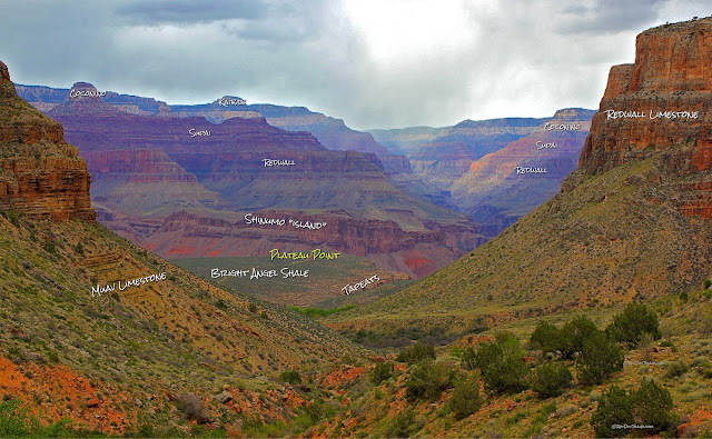
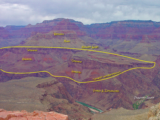
The Grand Canyon Supergroup is the mostly bright reddish, orange, purplish, and brown layered sedimentary rock layers near the river in the eastern part of the canyon. They are the only tilted layers in the canyon, and so can be easy to spot. Just the rocks we can see in the canyon are at least 12,000 feet (3.65 km) thick, and tectonic activity tilted them all about 15 degrees to the east. they were then eroded nearly flat before the Tapeats Sandstone was deposited. Geologic Islands: While the Grand Canyon Supergroup was being eroded down, a very hard, resistant layer was not eroded and stood up as hills, or islands in the rising sea -- the Shinumo Quartzite near Phantom Ranch and the B.A. trail. The Tapeats Sandstone and Bright Angel Shale were deposited around the islands. You'll see this from Plateau Point.
The Vishnu metamorphic and Zoaraster igneous rocks include schist and granite about 1.7 Billion years old. From a distance they are the non-descript brown to gray to pinkish mass in the inner gorge. The contact between them and the sedimentary Grand Canyon Supergroup is called the "lesser unconformity" because it represents a mere 600 million year gap in time.
Geology of the Bright Angel Trail
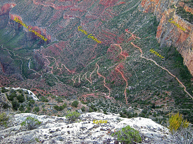
View almost straight down on the Bright Angel trail from the rim. The trail gets across the tall Redwall cliffs by going through a gap created by the Bright Angel fault. Is it me, or is everything here called "Bright Angel?"View down the Bright Angel trail from the upper trail.
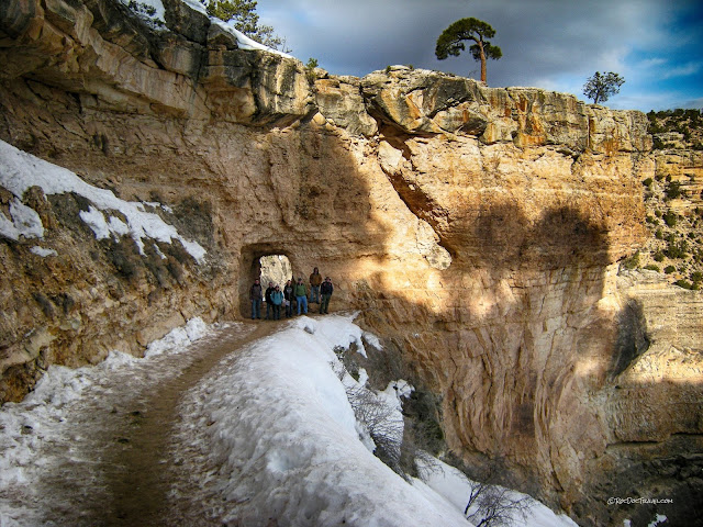
The Bright Angel trail has two tunnels that help hikers avoid perilous go-arounds. The trail largely follows Indian trails that date back hundreds of years - except, of course, for the tunnels.
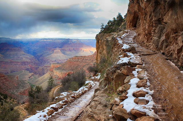
You can encounter snow on the Grand Canyon rims any time from October through mid-April. Just enjoy the views!
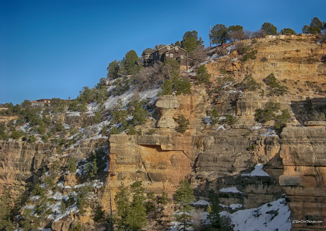
The Kaibab cliffs and Kolb studio.
You'll get so tired of these erosion control steps! We started calling them "tripping logs." But when you consider the high number of people and mules that use this trail, you may understand why the Park Service went through all this trouble to cause us all this trouble.
This is how the trail can look in early Spring. Removable crampons are advisable for late Fall through early Spring hikes.
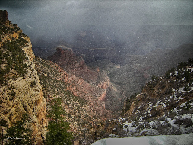
Hiking the trail in late March or earlier, you may encounter snow squalls like these. Remember, the rims of the Grand Canyon are high elevation!
The Coconino sandstone formed in coastal dunes. In the cliffs you can see the cross-bedded layers that formed when the wind blew hundreds of millions of years ago.
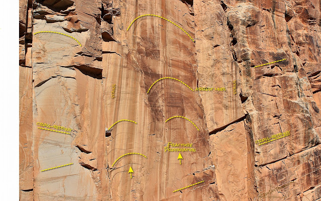
(Above) In addition to cross-bedding, many of the sandstone cliffs show marks left by fracturing. Arrest lines or ribs are the arcs that represent snapshots in time while the fracture propagated. On the cliffs, most ribs indicate upward growth as slabs fractured and broke off. The brownish vertical stripes you see everywhere are stains from rain washing dirt down from above.
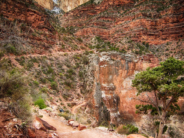
The Bright Angel fault drops the east side of the Coconino and Redwall cliffs (shown here), creating a gap for the trail. The fault is the vertical end of the Redwall cliffs by the trail, and the gully follows the fault up to the top.
Look closely in the fault zone, and you'll see that the rocks are crushed and polished. A polished surface like this created by movement of the fault is called a slickenside.
The trail has a lot of beautiful little spots.
Nice view of towers of the Coconino Sandstone.
The biggest geologic feature most tourists miss at the Grand Canyon is the "islands" of Precambrian Grand Canyon Group that stand above the Great Unconformity. The best one is across the river from Plateau Point. It is the group of rock layers tilted to the east. The brownish cliff-former is the Shinumo Quartzite, a very hard sandstone. It rests on top of the brightly colored Hakatai Shale. The Great Unconformity formed when all of the tilted Grand Canyon Group layers were eroded down to sea-level -- except for the hard, resistant Shinumo Quartzite, which stood up as islands in the ocean. The Tapeats sandstone (the layer you stand on at Plateau Point) and Bright Angel shale were deposited around the island as the ocean covered the area and deepened. You're literally looking at a 550 million year old island!
The lower Bright Angel Trail.
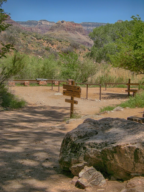
The trail splits at Indian Garden. To the left is the easier trail to Plateau Point and its spectacular views of the inner gorge. To the right is the trail down to the river and across a bridge to Phantom Ranch and the Kaibab trail.
The lower Bright Angel Trail follows the creekbed down to the river. This is a view from the Plateau Point trail.
Plateau Point offers some of the most spectacular views in the Grand Canyon. It is a table on top of the Cambrian Tapeats sandstone, with a thin veneer of the Bright Angel shale on top of it in places.
Plateau Point.
View to the west from Plateau Point showing the Great Unconformity and an adventurous young man. Being out in the middle of the canyon with high cliffs all around you gives you the real feel of the Grand Canyon. Look for cross-bedding and coarse layers in the Tapeats sandstone -- the cross-bedding here formed in river flow, and the coarse layers were deposited by faster-moving water, often in spring run-off or floods -- all of this, 525 million years ago!
View from the south Kaibab trail of the tilted Shinumo "island." It pokes up through the Tapeats and much of the Bright Angel formations, which were deposited around it. (USGS photo with my annotations).
For the adventurous who take the trail to the river, you'll find the near bridge that takes you to Phantom Ranch and the north Kaibab trail. The far bridge connects the north and south Kaibab trails. The inner gorge rocks here are the Vishnu Schist and Zoroaster Granite, both about 1700 million years old and full of fascinating igneous, metamorphic, and deformational features. (USGS photo)
Good view of the lower strata from near Plateau Point, facing back up the trail.
When it's time to head back up, you'll suddenly realize how far down you came!
Related posts: Rafting I, Rafting II, Rafting III, Rafting IV, North Rim (coming soon), Vulcan's Throne (coming soon)
B.S. -- Common Misconceptions About the Grand Canyon
My favorite myth about the Grand Canyon is that it formed in Noah's flood. First, the canyon cuts through a plateau -- any running water would have gone around the highland, not through it. Second, removal of so much material obviously could not take place in any short time frame. Third, some have suggested the rock layers themselves formed as flood deposits, when in fact most of the rocks show clear evidence of being deposited by wind or in calm water.Another myth is that the Grand Canyon is some kind of crack in the ground. If that were true, the rock layers in the bottom of the canyon would be separated as well, but they are not.
M.S. -- More Science:
USGS photo tour of the South Kaibab and Bright Angel trails: Here.
USGS geologic map: HERE.
Selected references on the Grand Canyon geology: HERE.

