Grand Teton National Park, Wyoming
Grand Teton National Park
Discover the amazing geologic story behind one of America's most scenic places!
What's in Grand Teton National Park?
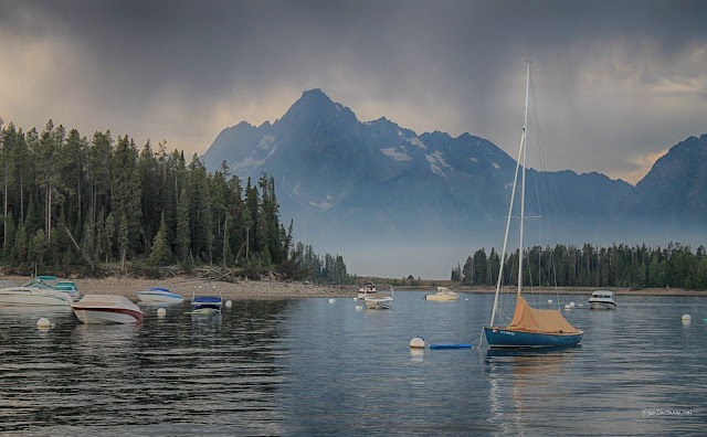
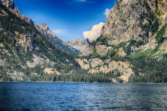
Located in northwestern Wyoming, Grand Teton National Park is adjacent to the Idaho state line and Yellowstone National Park. In addition to the spectacular glaciated peaks, the park contains scenic lakes (both wilderness and boat-friendly), world-class hiking trails, abundant wildlife, the upper Snake River, top-notch visitor facilities, and so many breath-taking views you'll be breathless!Jackson Lake at Leek's Marina.
Travel to Grand Teton National Park
Interactive Google map of Grand Teton National Park
Route: This trip starts at Jackson Lake and ends at Moose. If you can, also take the Moose-Wilson road for its wildlife and forest scenery.
Lodging: Plenty of motel, camping, and RV park options are available in the park and at Jackson, Wyoming. Prices vary a lot by location and season, so search your options pretty thoroughly.
Logistics: There are visitor services and food at all major sites in the park.
Vehicles: Any. Nothing in the park is steep. The only road with restrictions is the Moose-Wilson Road, which is too narrow for large vehicles or RV's.
Elevation: the park is all at 6800 feet (2073 m) or greater, so be prepared for colder temperatures and different weather than elsewhere in the region! Nights are cold - 40's in mid-summer.
Seasons: The west side roads are closed November through April, except to Jackson Hole Mountain Resort. Check conditions at the park's website.
Geology and Scenery of Grand Teton National Park
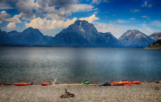
We'll start this tour from north to south, from Jackson Lake to Moose.ColterBay has the main docks on Jackson Lake. The deepest part of the lake is along the mountain front opposite of Colter Bay. While most of the lake is less than about 30 feet deep, there it's over 325 feet deep.
These innocuous little hills near the Colter Bay turn-off are actually some of the most important and interesting geologic features in the valley! They are glacial moraines - piles of gravel carried and dropped there by the massive glaciers that flowed southward out of Yellowstone and all the way to Jackson Hole. You can recognize them by their lumpy shapes, often ridge-like layout, and coarse gravel composition that includes boulders. Below, we'll look at moraines formed by the glaciers flowing out of the Teton canyons.
Mt.Teewinot from the Jackson Lake Lodge, with Donoho Point island in the lake. The Grant Teton is hidden behind Teewinot from this angle.
A wider view of the Tetons from Jackson Lake Lodge, with Mt. Moran on the right. The lake occupies broad flats and the Snake River drainage.
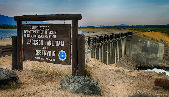
Jackson Lake was enhanced by construction of the dam on the Snake River. The natural lake occupied just the deep section west of Colter Bay near the mountain front.
Mount Moran viewed from the Signal Mountain marina shows the amazing topographic relief down to the canyons on either side - more than the depth of the Grand Canyon!
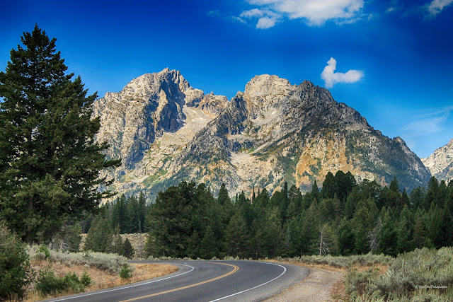
The view as you drive south toward the central Tetons makes it hard to pay attention to the road! The jagged peaks and deep, steep-sided canyons are the product of glaciation. Ice is a very efficient jack-hammer and conveyor belt, carrying massive amounts of rock out of the mountains. Earth has spent 90% of the past 2 million years in ice ages, with relatively brief warm periods between.
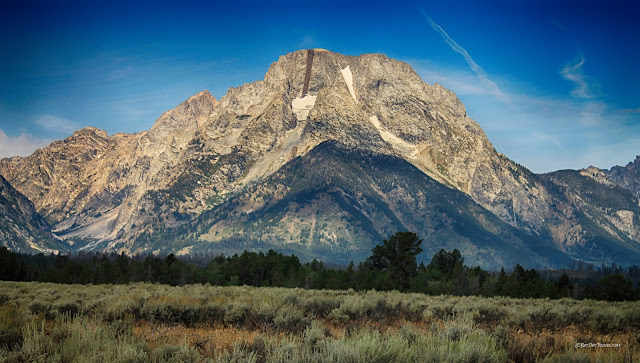
Mt. Moran is a geologic wonder! See the black stripe? That's a 150 foot-wide dike of dense ultramafic (high in iron and magnesium) rock called gabbro (or diabase) that was injected into fractures about 775 million years ago. Because it is more resistant to erosion than the gneiss that surrounds it, it sticks out from the cliff face up to 200 feet. The dike continues westward for more than 6 miles until it is covered by younger sedimentary strata.
Now for the really cool part - the dike truncates upward below that thin tan sandstone. See it? The sandstone is Cambrian, about 510 million years old. So on Moran, we can see a sequence of events:
1. Deposition of sedimentary rocks and basalt lava flows.
1. Deposition of sedimentary rocks and basalt lava flows.
2. Deep burial and metamorphism of those rocks.
3. Intrusion of granite into the metamorphosed rocks.
3. Intrusion of granite into the metamorphosed rocks.
4. Intrusion of the gabbro into a fracture and cooling into hard, crystalline rock.
5. Uplift of all the rocks and erosion to a flat surface.
6. Deposition of the sandstone.
7. Uplift of the Teton Range (beginning about 9 million years ago) and erosion of thousands of feet of sedimentary rocks off the top.
8. Glaciation carves out the canyons and deposits moraines.
9. You read this.
10. You visit the Tetons!
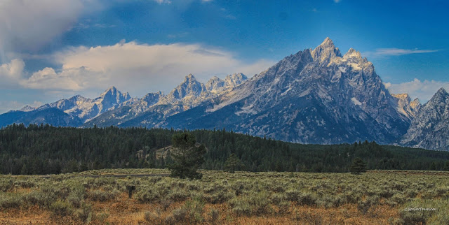
The high, sharp peak is Teewinot, and the deep canyon to its right is Cascade. Jenny Lake is at the mouth of Cascade Canyon. Teewinot is made of 2.7 billion year old banded gneiss that has a lot of dikes (other igneous rocks that filled and hardened in fractures) in it - a very interesting rock to look at! The hill in the foreground is the Burned Ridge moraine, a gravel pile left there when the glaciers melted around 12,000 years ago. You can recognize moraines by the wide variety of rock sizes in the gravel, everything from sand up to car-size boulders. Glaciers aren't picky about what they'll carry!
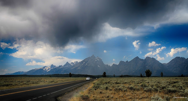
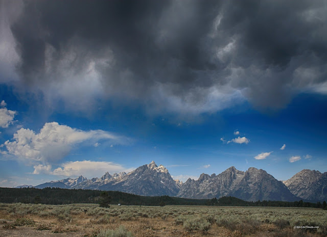
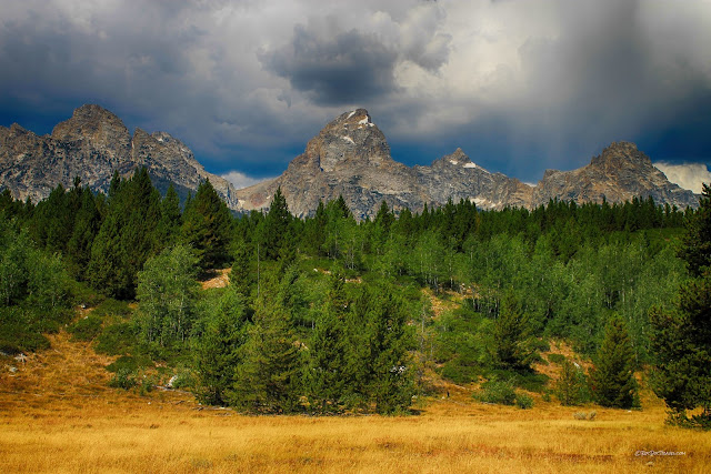
Here's a wider picture, still with the Burned Ridge moraine in the foreground. The mountains to the right of Teewinot are Symmetry Spine, Mt. St. John, and Rockchuck Peak, all made of the 2.7 billion year old banded gneiss. Summer thunderstorms are a regular occurrence in the Tetons, so be prepared!
The jagged shape of Teewinot and the other Teton peaks is caused by the effects of glaciation on crystalline / metamorphic rocks. There's no obvious large-scale layering in the bedrock (like there is in the Grand Canyon), and so when the bedrock is attacked by ice (the ferocious, powerful alter ego of water), pointed peaks and steep-sided canyons are left behind. Layered bedrock would form blockier peaks, like those in parts of Montana, central Wyoming, and Colorado.
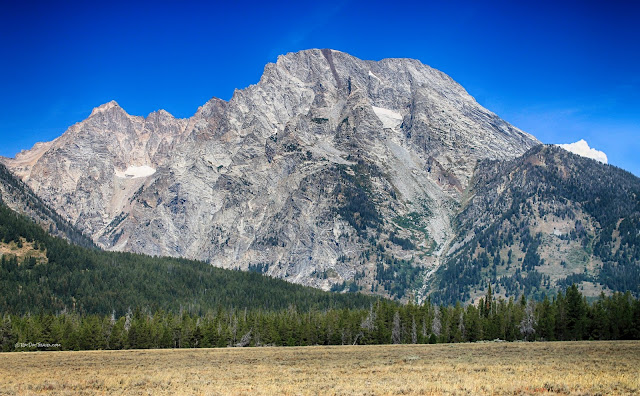
Here's a sunnier look at Mt. Moran and its famous gabbro (or diabase) dike. The valley elevation here is 6800 feet (2073 m), and the peak is 12,605 feet (3842 m), so that's a big mountain front!
The photographer in your group should not be the driver! Mt. St. John and Rockchuck Peak are separated by a glacially carved valley. Ice has also gnawed into Rockchuck at that front cliff. The gneiss and granite bedrock of the Tetons is not easily eroded except where it contains a lot of fractures, which give ice entry to do its damage and carry away the loosened rocks.
Teewinot and its neighboring peaks were not so much "carved" into those shapes, but more like "plucked." Ice isn't a strong material, but it does have one unique attribute that makes it powerful against rock: it expands when it freezes. It's the only common natural material that does. It shaped these peaks by freezing in fractures, small and large, and "jacking" the cracks wider. Piece by piece, slopes break into cliffs and glaciers carry the debris away. Notice how small the talus (rock debris) slopes are in the high Tetons? That's because they formed only after the glaciers were gone. Ice plucked away at the cliffs, causing the cliffs to retreat higher and higher into the mountains. The remaining peaks are the lucky rocks farthest between the retreating cliffs. Sharp peaks formed this way are called "horns," the most famous example being the Matterhorn on the Swiss-Italian border. But Wyoming has its Teton horns!
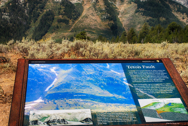
The Teton range was uplifted three times, the most recent being along the range-front fault. The only place it's easy to spot is just north of Jenny Lake at this turn-out. In the sign's photo, it's the band in shadow.
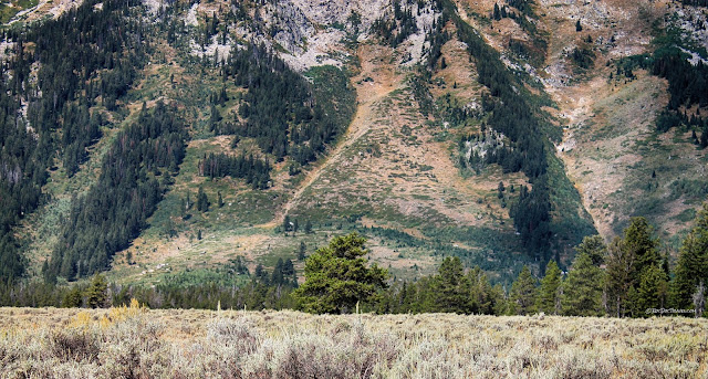
In this photo, the fault scarp is the darkly vegetated band across the lower slopes. This fault scarp is the result of several large earthquakes, the most recent of which was about 7000 years ago. But keep in mind that not every earthquake ruptures the ground surface - only the biggest do - and so there have likely been hundreds of smaller quakes since the last big one. This fault is capable of generating a M7.5 earthquake. There is no way to know when it will happen.
Mount Moran viewed from near Jenny Lake. You can still see the big dike.
Jenny Lake is the only mountain-front lake you can drive to, so it's very popular and can be over-crowded. The lake is dammed in by moraines from the Cascade Canyon glacier. When you're there, notice the very rocky hills the road and facilities are on, and how big some of the boulders are. They are all bedrock carried on top or bottom of the Cascade glacier and dropped here when it melted about 12,000 years ago.
Take a big memory card for your camera! It's hard to stop taking pictures here.
On the north side of Cascade Canyon are Storm Point and Mt. St. John, both made of the 2.7 billion year-old banded gneiss.
Cascade Canyon was formed by glaciers and, during warm interglacial periods like today, by stream erosion. Those outcrops at the canyon mouth show just how resistant to erosion the gneiss is.
The Tetons are being uplifted along a fault. See the common 50 degree slope on all the mountain fronts? That's the dip of the fault. The range is being pulled up and out from under the valley - or to look at it the other way, the valley is sliding off of the mountain range. When an earthquake occurs and the fault slips, the mountains rise a bit and the valley drops a bit.
Once you're south of Jenny Lake, the Grand Teton (center) becomes visible. That's Teewinot on the right, and the middle and south Tetons on the left. Mt. Owen just peeks out between Grand and Teewinot.
See the snow just to the right of the Grand's base? That is the Teton Glacier. To be called a glacier, a field of ice has to be thick enough to deform plastically, and it has to move. The big gravel pile in front of it is the moraine from the 1920's. Glaciers grow and retreat as precipitation and temperature levels fluctuate. That's Mt. Owen to the right of the Grand.
"The three Tetons," South, Middle, and Grand. They are horns, peaks formed between glacial valleys. The Middle Teton has a vertical mafic dike like Moran does - see it? These peaks are geologic sisters to the Matterhorn because they have similar bedrock and shapes. Their elevations are 12,513 feet (3814 m), 12,805 feet (3903 m), and 13,776 feet (4199 m).
This view really catches a geologist's attention! First, it shows the slope of the range-front fault very well, and second, it shows a sawtooth fabric in Mt. St. John. It's formed by a stack of dikes in the gneiss that erode differently than the gneiss.
Taggart Lake
Taggart Lake offers a gorgeous hike that nearly anyone can do.
Taggart Lake is located at the mouth of aptly named Avalanche Canyon, where both rock and snow avalanches are common. The lake is rimmed by moraines deposited by the canyon's glacier (the forested hills in the foreground). The formidable cliffs at the top of the canyon are known as "the wall."
The forested hills in front of the Tetons are glacial moraines, and some of them are huge!
The hills in Jackson Hole (valley) were overrun by the huge glacial sheet flowing out of Yellowstone at the peak of the last ice age. The ice smoothed them into long oval shapes by removing any and all loose or fractured bedrock.
The Taggart Lake trail starts just outside of the Avalanche Canyon moraines. As you go, notice how rocky the moraines are, and how huge some of the boulders are. Glaciers can carry anything, and they're not picky!
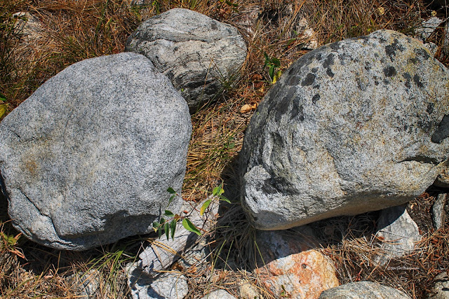
Rock Spotting 1: Look for these boulders of granite (left) and banded gneiss. When rocks are metamorphosed and sheared under high pressure and temperature, the minerals segregate based on how easily they deform. The result is light and dark colored bands.
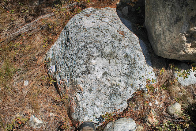
Rock Spotting 2: Watch for boulders of pegmatite, carried out of the mountains by the glacier from the dikes up high. Pegmatite is a rock with MOUS's - minerals of unusual size! They typically form after the main body of granite, and contain a lot of water that allows rapid mineral growth. The main minerals are quartz (translucent & glassy) and potassium feldspar (rectangular, white to pink). Pegmatites in other places often contain gem minerals (but not in the Tetons).
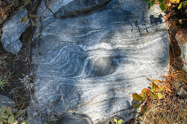
Rock Spotting 3: Watch for structures and patterns in the banded gneisses. This one has a roundish spot of dark minerals including amphibole that don't deform as easily as the lighter-colored minerals. The result is the other layers have flowed around it.
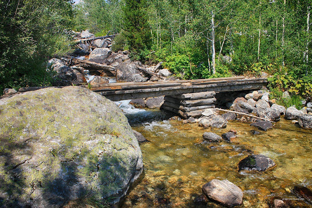
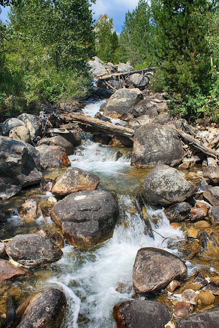
When you cross the stream, look at the incredibly big boulders in it! The stream is eroding through the moraine, removing the sand and small rocks and revealing the big ones.
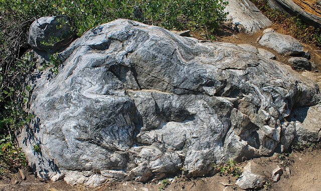
Rock Spotting 4: Watch for this huge banded gneiss boulder, and take a minute to look at the interesting folded bands in it. Keep in mind that the folding all took place in the solid state - the rock was not melted at all! To accomplish solid state folding, minerals deform and change shape in place, and some recrystallize and combine with each other.
I think these pack horses would like to change the sign! This was near summer's end, and they sure look tired. You can almost read their minds: "Not another tourist!"
Just keep your camera at the ready, because you'll want it out every few feet!
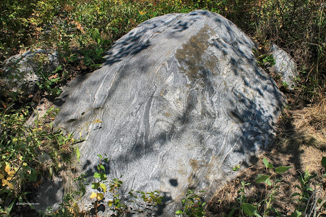
Note the huge granite boulder in the bushes. The trail crosses moraines, so we get to see just what the glacier carried out of the mountains.
It's fun to chat with other hikers. We decided it's futile to put our cameras away at all. You're likely to meet people from all over the world in Grand Teton National Park.
Rock Spotting 5: Watch for this thoroughly folded banded gneiss. This one is a good exercise for Geology students studying metamorphism and folding.
These gneisses are cut by dikes of quartz and potassium feldspar. All are over 2.5 billion years old.
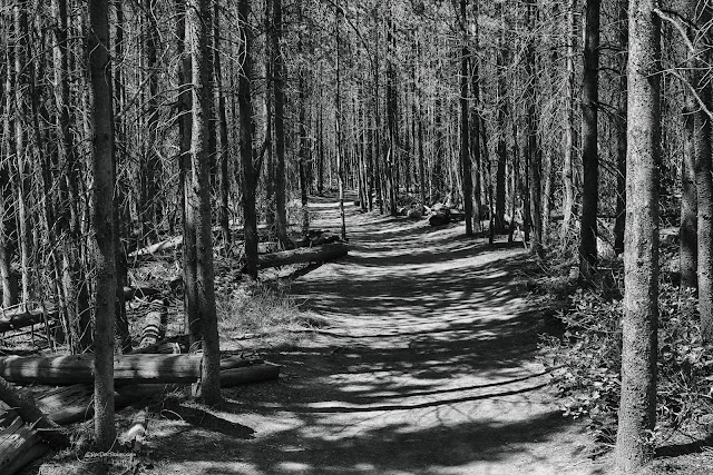
Some scenes are just best in black and white! I'd like to come here after a light snow.
Close to the lake, the trail parallels this low moraine.
Rock Spotting 6: Watch for this big piece of amphibolite. This metamorphic rock forms at very high pressures and temperatures from basaltic or shaly rocks.
Taggart Lake occupies the low area between moraines, just like Jenny and the other mountain-front lakes.
The lake's moraine origins explain the very rocky shore.
Moose
The Moose visitor center is a masterpiece! It includes information, restrooms, a bookstore, permits, and there are a store and post office nearby.
The 1936 White Motor Company buses used in Yellowstone and Glacier National Parks were restored a few years ago, and they're open for tours! This one was astray at the Moose Visitor Center.
Jackson Hole Ski Resort
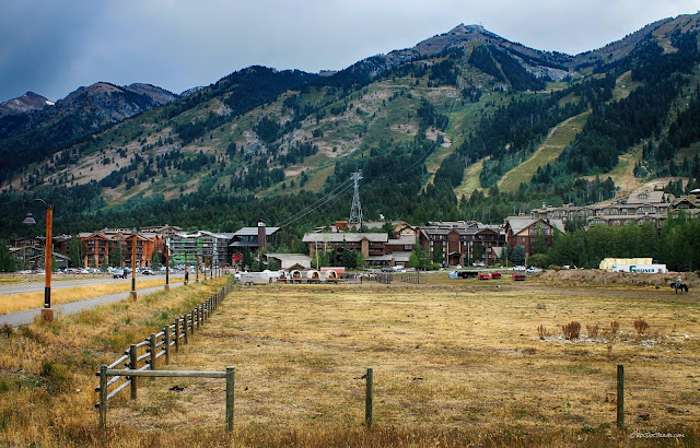
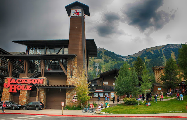
No visit to the Tetons would be complete without a visit to the Jackson Hole Mountain Resort. It's a truly world-class, 4-seasons resort. From Moose, take the Moose-Wilson road for the shortest and most scenic route. (Note: this road is very narrow, and not recommended for large vehicles or RV's).
The ski resort boasts one of the greatest vertical drops in North America at just over 4400 feet (1341 m). A main feature is the newly reconstructed tramway that takes you all the way to the top. Check the resort's website for prices and seasons.
Related Field Trips: On the right side "Places and Topics," click on Yellowstone or Wyoming.
M.S. - More Science
Geologic Map - at USGS.gov
About Grand Teton geology - at National Park Service

