Yosemite's Tioga Pass Road
Yosemite National Park's Tioga Pass Road
Explore the glaciated granite of the high country on the High Sierra's best road!Geology Galore!
Glaciated granite - large-scale exfoliation - glacial features of many kinds - high meadows - Half Dome from the high side - glacial lakes - deep weathering - phenomenal high mountain roadTravel to Yosemite
Travel: Yosemite is a drive-there, stay-there National Park. It's too far from real towns for a one-day or commuter trip.
Vehicle: Any. If you have an RV, you can park it and take shuttle buses to all the major attractions in the park, including high-up Glacier Point and all major trailheads.
Lodging in the Park: The park has a lot of options and a lot of capacity, from tent sites to platform tents to RV parks to motels and high-end hotels. See your options here.
Lodging outside the Park: The closest options are at El Portal or Incline outside the west entrance. Motels there are pretty pricey. You can go farther to save money, but that entails a daily drive up the winding canyon road. I stayed in Mariposa for more reasonable rates (still not low) and made the drive.
Food: The park has a remarkable number of places to eat, especially around the Valley Visitor Center and Half Dome Village. There aren't any on Tioga Pass road until you get far east to Tuolumne Meadows, so plan accordingly. Don't forget to take drinking water!Hiking: Wow! Just WOW! See trail info here.
Activities: See the park's website. No matter what your likes and interests, you won't be bored!
Other Facilities: The Valley Visitor Center and Half Dome Village areas have grocery stores, restaurants, museums, gift shops, showers, swimming pools, and a medical clinic.
Crowds: Yosemite gets as many visitors as Yellowstone (4+ million every year), but puts them into a small fraction of the area. Be prepared to be patient. Go off-season if you can (before June or after August), and avoid holiday weekends. Tuolumne Meadows can be just as crowded.
Seasons: You can visit the valley any time of the year, but the Glacier Point and Tioga roads are closed in winter. Check the park website for projected opening dates.
Drought: California has undergone an extended drought since 1998, but not every year is equally dry. The valley's waterfalls are of course major attractions, so to make sure you see them go in April to June or in a wet year.
Park Roads: Tioga Pass Road is highway 120, which leaves Yosemite Valley at the far west end of the park. Keep a map with you, and go only one short stretch of road at a time if you are having trouble finding anything.
Geology of Tioga Pass Road
The Sierra Nevada mountains are an enormous conglomerate of granite bodies called a batholith ("thick rock"). Think of a batholith as the amalgamated wax blobs in the top of a lava lamp, and you'll have a good picture of how the granites clump together. It formed in the Jurassic and Cretaceous periods when a Pacific plate was subducting under North America. Subduction results in generation of magma, which rises inland from the plate boundary to form a chain of volcanoes. Granite is the magma that crystallized underground below the volcanoes. Geologists call these "magmatic arcs" because they tend to be arcuate in shape. Examples of modern volcanic arcs are the Cascade mountains, the Andes, the Aleutian Islands, Japan, the Philippines, and many of the island chains of the South Pacific.
The magmatic arc shut off about 70 million years ago when subduction changed and eventually shut off to be replaced by the San Andreas fault. Then about 17 million years ago, the Sierra Nevada mountains began to rise. The east side of the range - the steep side - is fronted by a long series of normal faults that lift up the mountains and drop down the eastern valleys. That has made the Sierra Nevada into a huge wedge, high on the east and with a long westward slope.
Ice ages have occupied Earth 90% of the past 2 million years. Ice is very effective at plucking out and carrying huge amounts of rock. Something to remember about Yosemite's glaciers is that the entire high Sierra were covered by a thick mantle of ice. The high country you'll be exploring is above the amazing U-shaped valley of Yosemite, but was still covered by thick sheets of moving ice that carved and smoothed the bedrock.
On this field trip, you'll go up the ramp from the west all the way to the top in the High Sierra, and then down the steep eastern side and across the fault to Mono Valley at Lee Vining.
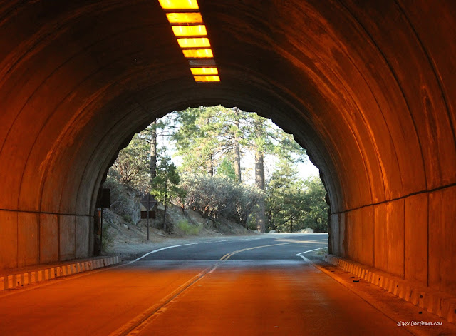
The lower part of Tioga Pass Road viewed from the opposite side of Yosemite Valley along the Glacier Point Road. The only way for a road to get out is to tunnel! The road was first completed in 1915, and the tunnels in 1937.
Yes, there is light at the end of the tunnel!
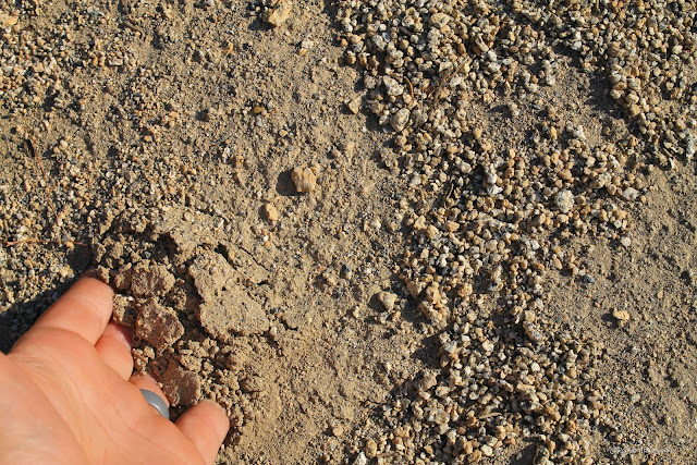
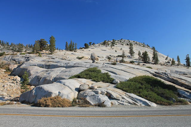
Away from the valleys deeply eroded by glaciers, the Sierra batholith is deeply weathered like this. Weathering is the chemical and physical process of breaking up rock.
"Grus" is the term for the sand-like sediment resulting from thorough weathering of granite. Physical weathering involves separation of mineral grain boundaries and microfractures, usually by ice wedging. Chemical weathering involves slow dissolution of feldspars (the white or pinkish, blocky minerals), which allows further physical weathering.
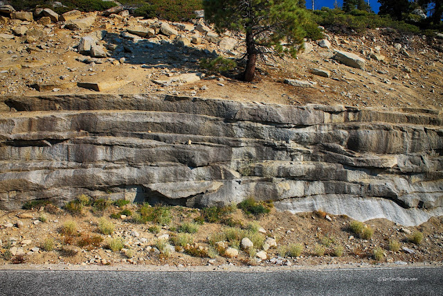
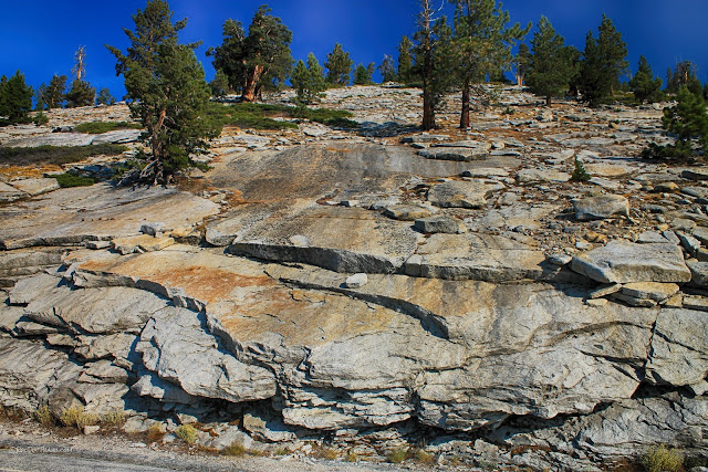
One of the principle geologic features geologists come to see is these fractures that peel the granite into sheets. The phenomenon is called "exfoliation," and it is caused by expansion of the bedrock. The granite originally formed several kilometers deep in the crust where it was under tremendous pressure. Uplift and erosion have removed all that pressure, and so the rock has expanded and fractured. The fractures generally follow the shape of the surface of the earth.
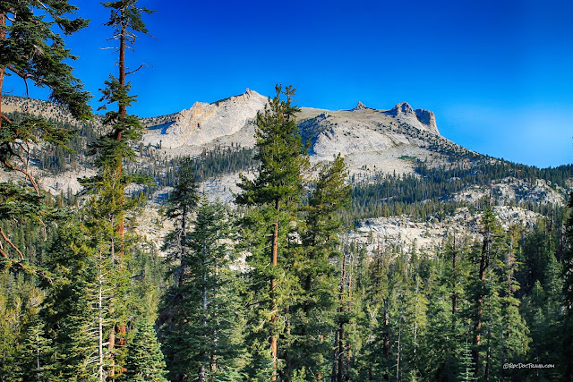
Mount Hoffman is visible from the rims of Yosemite Valley, and even better from the Tioga Pass road. It's 10,850 feet (3307 m), and made of - of course - granite.
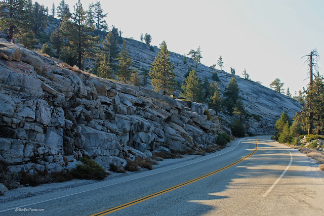
When a brittle material expands, it breaks in nearly parallel fractures parallel to the free surface. This road cut shows the expansion joints very well.
As you explore Yosemite and the High Sierra, you'll become familiar with slopes like this, developed on exfoliation joints. They make deep snowfall particularly hazards for avalanches.
This mountain is peeling like an onion!
This European vehicle would make any geologist's heart skip a beat!
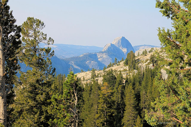
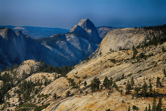
One of the real treats of the Tioga Pass road is the view back down into Yosemite Valley to see Half Dome. The dome itself is one of the best examples of exfoliation. Tenaya Creek's valley extends almost all the way up to highway 120.
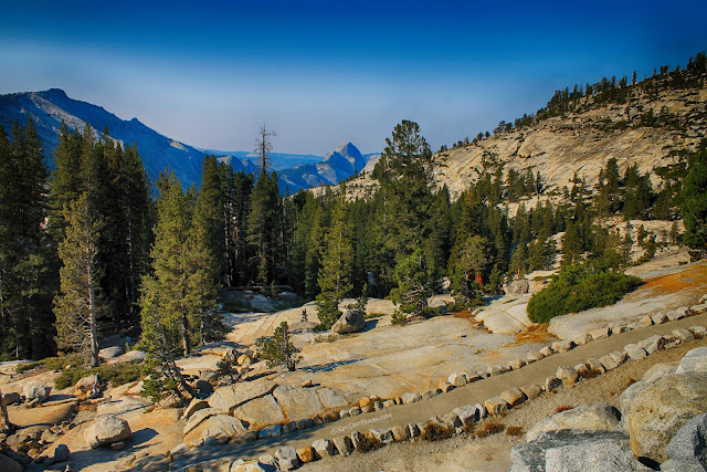
Glaciers plucked off all the loose rocks, leaving behind the intact, smooth sheet-like slopes. Exploring them is one of the uniquely High Sierra experiences you simply must try. Just get out and walk!
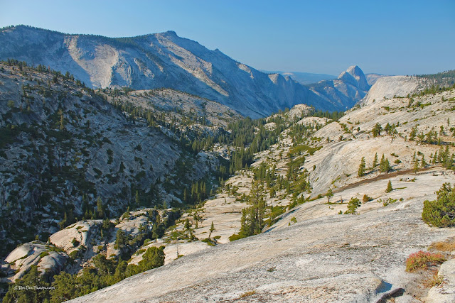
Put the Olmsted Point Overlook on your must-see list! Take a short (or long!) hike out the trails to explore the exfoliated granite surfaces and take in the spectacular view down to Half Dome. Coordinates: 37.810736, -119.485251
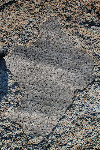
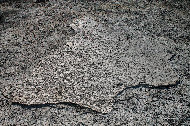
Because they pluck out loose rocks and drag them along the bottom of the ice, glaciers polish and scrape smooth the bedrock. These striations indicate the direction of ice flow, and you'll see them all over. The polish creates a very low permeability coating on the rock that resists erosion, so patches of them are frequently preserved even after thousands of years. This one is about a foot across.
Here's a view of Half Dome from the trail from Olmsted Point. It shows the pervasiveness of exfoliation.
Exfoliation sheets make a unique hiking experience! I like to tell kids this is "ogre weathering," because the rocks peel like onions, and you know what Shrek said about ogres (if not, look it up!).
This glacial striation is polished enough to reflect the sun.
In the right sun angle, you can see exfoliation joints on nearly every mountainside.
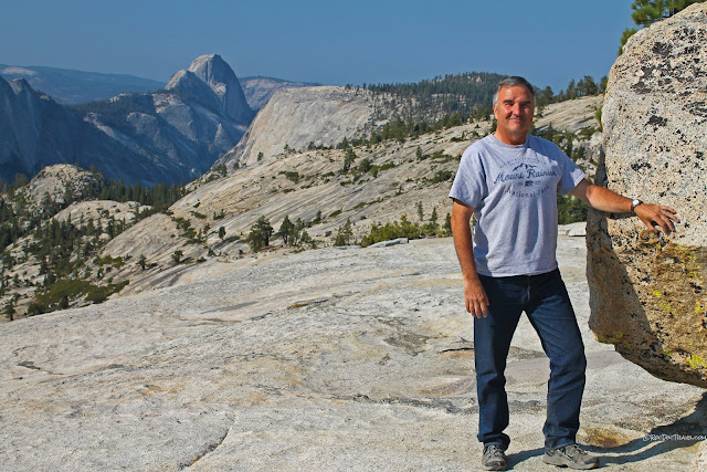
The Roc Doc rests his arm on a boulder dropped by a glacier, after soaking in the view of Half Dome.
Knowing when you've taken enough photos at Yosemite is a superhuman feat. When I wandered into this view, I knew I still needed more.
Looking east from Olmsted Point. The highway meanders out through those mountains.
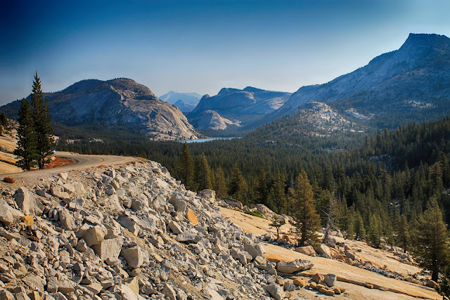
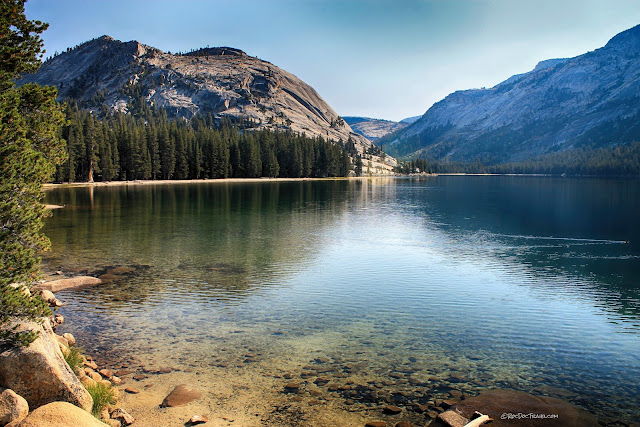
Tenaya Lake is the source of Tenaya Creek, which flows past Half Dome into Yosemite Valley. This low spot was plucked out by glaciers when the ice found abundant fractures to finger into.
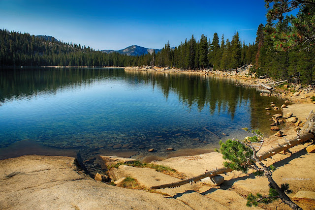
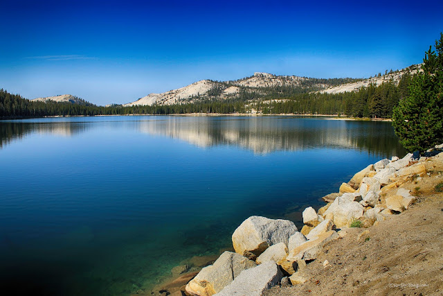
Because the Sierra Nevada mountains contain very little clay, the streams and lakes stay quite clear.
Polly Dome just past the lake is another great exfoliation dome.
Looking back west over Tenaya Lake.
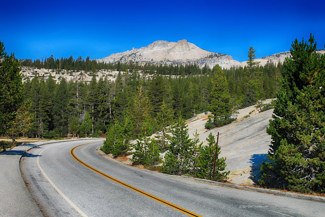
Mount Hoffman rises formidably in the distance where the road passes an exfoliation slope.
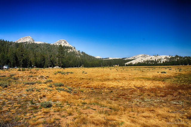
Tuolumne Meadows is at 8600 feet (2620 m), and is one of the biggest meadows in the Sierra Nevada. These pictures were taken in a severe drought year when the grass was thin and brown, but you can see the meadow in its splendor at the National Park's website.
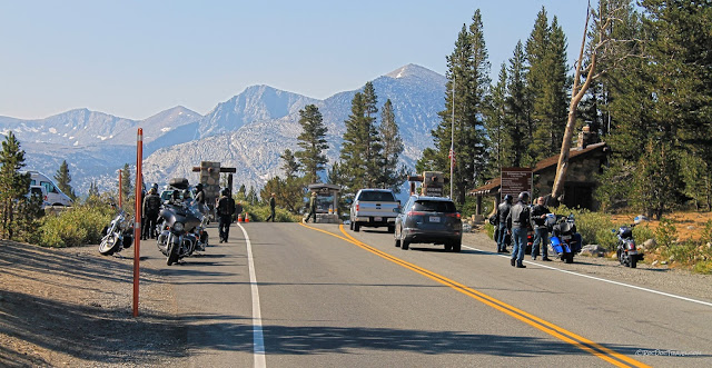
The National Park's east entrance is east of Tuolumne Meadows at Tioga Pass, elevation 9950 feet (3033 m).
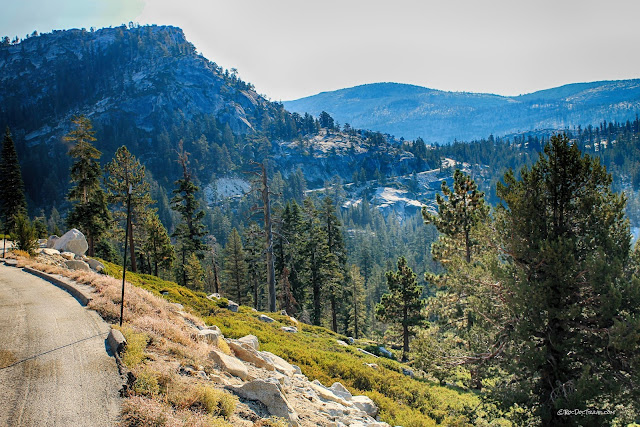
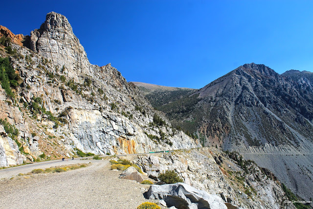
Your journey is not over at the park boundary! The road slices down the steep eastern side of the Sierra across formidable terrain. This view looks back up the road just east of Tioga Pass...
... and this view looks down the great road to the east. It's easy to see why this road is closed half of the year for snow! To me, this ranks right up there with Glacier National Park's Going to the Sun Road as one of the most awe-inspiring roads in North America. It may not have the lush forest of others, but it has as much or more topographic relief and spectacular bedrock. This section of road was first built in 1899-1905.
This spectacular white granite peak rises high over the road. It is surrounded by remnants of the volcanoes that once covered the entire granite. Most have been removed by erosion, but this area contains "roof pendants" - remnants of volcanic rocks sitting on top of the granite.
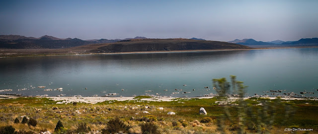
Where highway 120 meets U.S. 395, you'll see Mono Lake and its valley with fairly young volcanic rocks. Mono Lake has long been the contentious symbol of California's water battles. It has been shrinking since its major water supplies from the Sierra were diverted into the great canal system that feeds thirsty Los Angeles.
This dark basalt lava flow at Black Point in Mono Lake is part of a volcanic system as young as 200 years that extends all along the eastern Sierra Nevada.
Related Field Trips: Yosemite Valley, Yosemite from Up High
M.S. - More Science
Geologic Map of Yosemite from the U.S. Geological Survey here.
Geologic Map of the Tioga Pass area here.
Geologic Map of Tuolumne Meadows here.
